Whether a lack of navigation skills is your guilty secret, or you're a compass-wielding pro, the mountains always have something to teach us. Inventors of the world's first ever liquid-filled compasses, SILVA takes a looks at map and compass skills, and explains why they're as relevant today as when they were first invented in 1933.
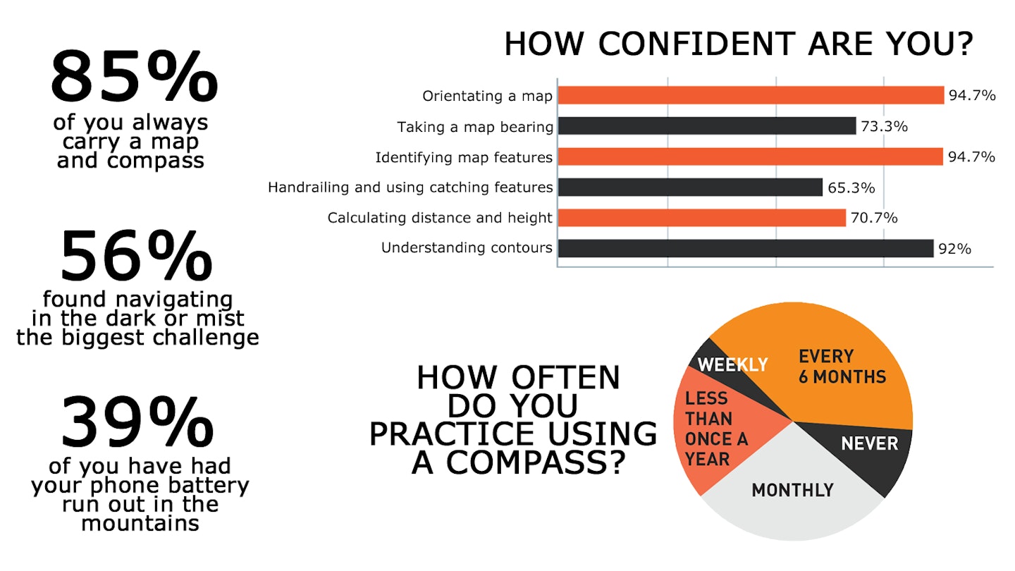
Navigation in numbers
Mountain terrain can be complex and confusing – conditions can change from bright sun to 20m visibility in mere moments. So navigating in the mountains is a skill that needs regular practice! Despite the popularity of GPS gadgets, navigation errors are still the second biggest cause for Mountain Rescue call-outs.
To delve into the navigational trials and tribulations of regular mountain-goers, we asked our Everest Anywhere Facebook community about their experiences…

Stop, Check
“If I was asked for the most important golden rule for my adventures in the hills, it would be to tell someone where I am going. This could be as simple as sending a text to a pal with a rough idea of my route and when I plan to return. That way if the worst happens then someone has some idea where I was heading.”
Heather Morning, Mountaineering Scotland
Phone Away
“One very simple piece of advice is to keep your mobile phone for what only a mobile phone can do! Mountain Rescue teams need to keep in contact with casualties, and can also use apps to locate them using a phone’s GPS. None of this is possible if the phone is out of battery power. Keep a phone fully charged and out of use in your bag in case of emergencies, or carry a power pack as reserve charge. And carry a torch, map and compass rather than using your phone for light and navigation.”
Mike Margeson, Operations Director, Mountain Rescue England and Wales
Night Nav
“Most people’s feel for distance and sense of direction is thrown out of kilter at night. Know how many minutes you take to cover 1km on average terrain, and know how many paces it takes you to cover 100m. Keep a closer eye on the compass – keep it out, not in your bag or in your pocket. If it’s misty the light can bounce off moisture, making it difficult to see. Using a second headtorch around your knee can help.”
Sean Bolland #TheNavGuy, Adventure Trails
Always Pack
- A map in an attachable case so it can't blow away
- A good quality compass
- Consider a back-up such as a GPS gadget or location app
- A headtorch plus a spare
- A phone call for help
- Battery pack and charging lead for phone and nav gadgets
Easy as 123
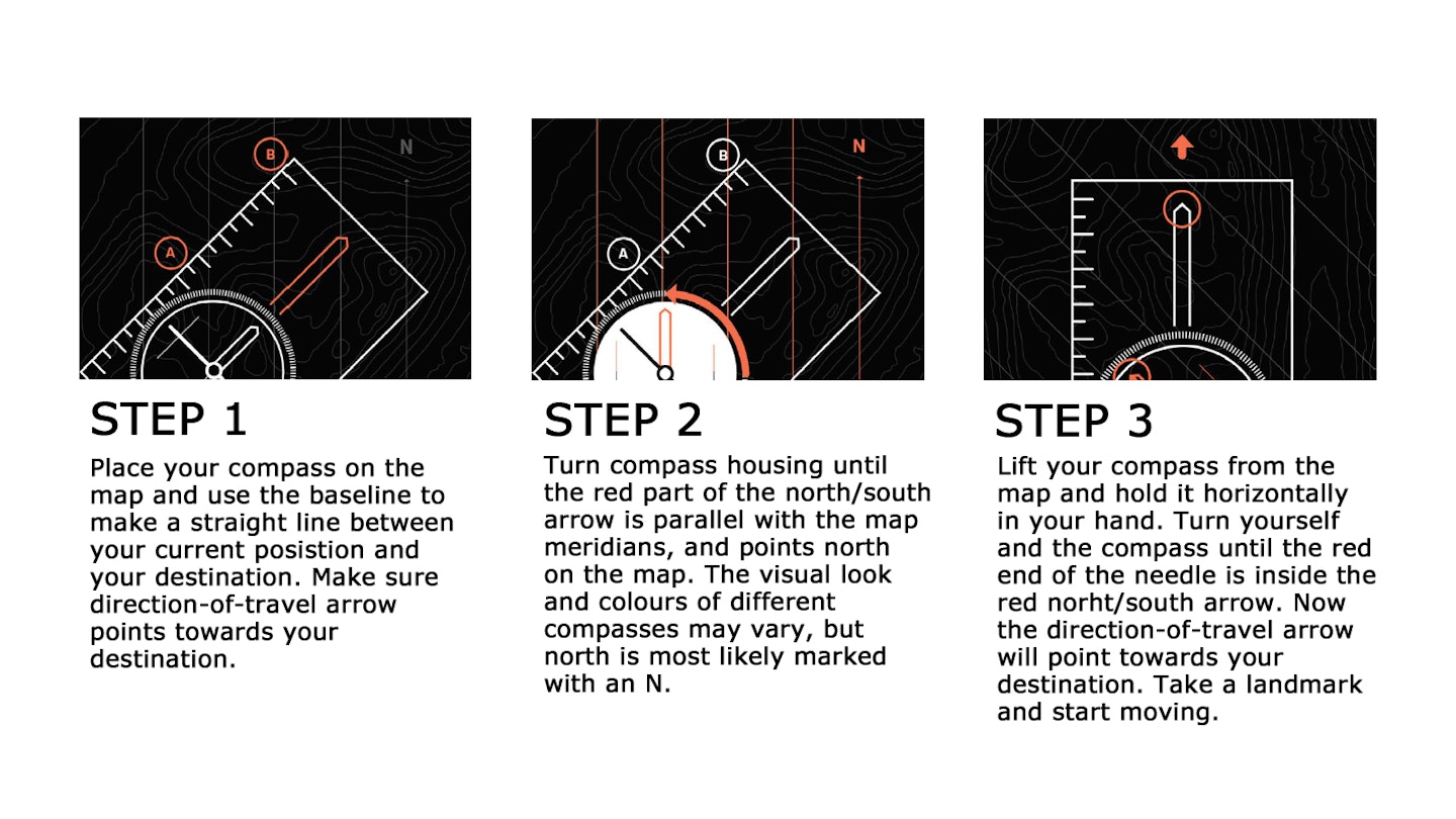
Navigation all comes down to solid basics. SILVA’s 123 to navigation sets a foundation for core advanced skills. Practising using a map and compass on your local walks is a great idea. Go out in the dark to imitate low-visibility conditions that might catch you out in the mountains, so you are prepared and practised in a safe environment.

What is...?
Handrailing This is when key linear features are used as visual handrails to follow, e.g. rivers, wall/fence lines, paths, lake shores etc.
Catching features These are features that will tell you if you've gone too far, e.g. "I know if I head in a northernly direction and hit a woodland then I've missed my turn and need to backtrack"
Naismith's Rule When planning routes this is a rough guide to how long it will take you to travel a specific distance at various speeds. Time and distance are crucial parts of learning more advanced navigation. You can also work out how man paces it takes you to cover 100m, and then use this info to pace out the distance to your next target on the map.
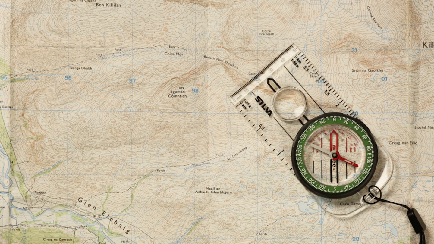
Orientating the Map Sounds simple but it's worth practising regularly. To determine your direction of travel and align the map with your surroundings, lay the compass on top of the map and rotate the map so the vertical lines and north on the map are pointing in the direction of the north needle on the compass.

WIN £50!
SILVA is giving away five £50 vouchers to spend on compasses, headtorches or packs on the SILVA webshop at silvasweden.uk
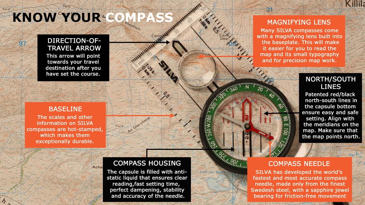
All you need to do to be in with a chance of winning is tell us what colour the North needle is on SILVA compasses.
Enter herebefore 9th June 2021.

