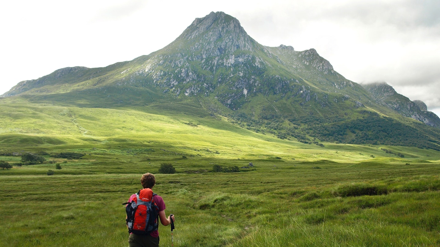
Ben Loyal is often known as the ‘Queen of Scottish Mountains’. While any royal connotations with its name appear to be wrong, it does have an impressive castle.
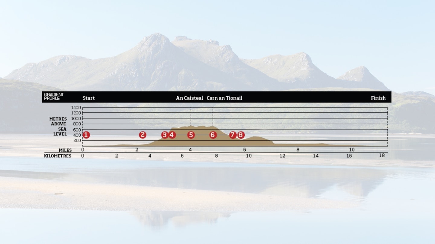
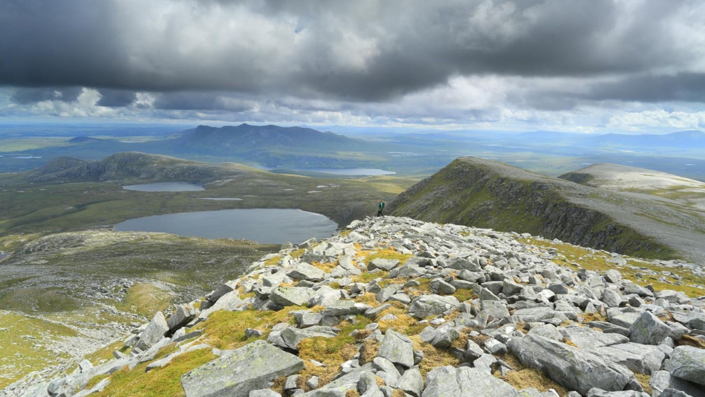
The granite tower of An Caisteal ('The Castle) is Ben Loyal’s highest top at 765m and is just one of the five rocky tops that crown the ridge. This circular route takes in all five castellations. From each of the tops, you gain fantastic panoramic views over the surrounding countryside, composed as it is of vast swathes of wild land and water.
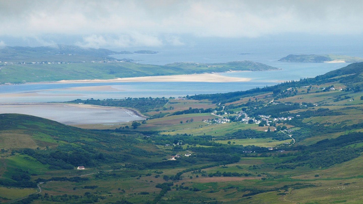
The shifting white sands of the Kyle of Tongue in particular are a sight to be seen. In the middle of the Kyle you can see the Rabbit Islands, so named because rabbits were introduced to them in the 1700s to provide meat for the local laird. You also look down to the small Lochan Hakel, notable for potentially containing Jacobite treasure.
In 1746, the Hazard – a Jacobite ship carrying over £13,000 in gold coins to fund Bonnie Prince Charlie’s rebellion – brought the coins ashore but the crew were attacked and threw the coins into Lochan Hakel. Bonnie Prince Charlie sent 1,500 men to recover the money, but they were defeated en route and the government is thought to have recovered most of the coins.
The 1,500 men may have made a difference to the outcome of the Battle of Culloden and it’s just possible that the depths of Lochan Hakel still contain some Jacobite gold to this day. Castles and abandoned gold aside, Ben Loyal, with its commanding position on Scotland’s far north coast, is a treasure worth visiting in itself.
How long does it take to climb Ben Loyal?
DIFFICULTY: Medium/Hard | DISTANCE: 19km (11¾ miles) | TIME: 6.5 hours | TOTAL ASCENT: 960m
FITNESS: It's a good leg stretcher and the ascent of almost 1000m isn't to be sniffed at, but experienced mountain walkers can handle it.
TERRAIN: A good walk-in along tracks gives way to grassy slopes, less challenging and steep than the rocky peaks of Ben Loyal might suggest.
NAVIGATION: This is Scottish mountain terrain, so you need to know your stuff. Don't even consider heading up Ben Loyal if you don't have map, compass and the skills to use them.
Where is the start of the walk?
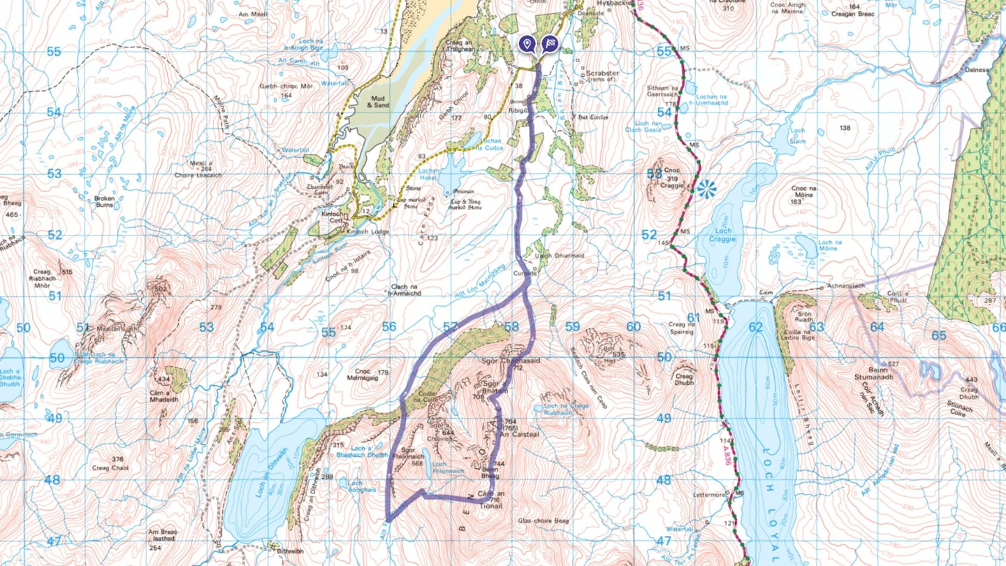
The nearest town is Tongue. Start and finish at Ribigill Farm.
What's the best map for Ben Loyal?
-
CLICK HERE to view and download our digital route guide in OS Maps
Ben Loyal | Step-by-step route guide
-
Start at the turning to Ribigill Farm off the minor road around the Kyle of Tongue. There is parking for a couple of cars, or you could walk here from Tongue. From the start follow the road to Ribigill Farm, going left where it splits to pass between the farm buildings. Continue along the track from here, which runs between the fields heading towards Ben Loyal. Ignore a fork off to the right to head left and across a small ford. This track takes you across level boggy ground towards the ruined farm of Cunside. Continue along the track until you reach the Allt Lon Malmsgaig.
-
Cross the Allt Lon Malmsgaig to the same side as Cunside but then leave the track to take a small path heading south towards the Bealach Clais nan Ceap. This climbs up the right-hand side of a small burn.
-
Leave the path at this point, before you reach the bealach to climb steeply south-west up the shoulder of Sgor Chaonasaid at the end of the Ben Loyal ridge, gaining the summit of Sgor Chaonasaid from the south. From here there are fantastic views of the ever-changing sandbanks in the Kyle of Tongue.
-
Follow the ridge from Sgor Chaonasaid to pass over Sgor a’Bhatain (708m) and come to the rocky summit of An Caisteal. This seemingly impenetrable mass of rock is in fact easily gained by heading to its west side from where a small path takes you to the summit (765m). All other routes would involve a serious rock climb. This rocky castle offers 360 degree views.
-
To carry on from here, and complete a full traverse of the ridge, return to the west side of the summit of An Caisteal, then go south along the ridge to Beinn Bheag (744m). Carry on south down, then ascend again, to the top of Carn an Tionail (716m), the last top of the ridge.
-
From here, head west down grass and heather slopes to come to the top of a gully. Follow the gully down, still heading west, to meet the Allt Fhionnaich and head down its left bank, crossing before it enters a steeper gorge.
-
Once on the other side of the gully, head south-west down the side of the Allt Fhionnaich until you reach gentler terrain and are west of the crags of Sgor Fhionnaich.
-
From here, head north then north-east, around Sgor Fhionnaich before following a second burn down through the birch forest to level ground below. Continue north-west across rough grassland to rejoin the path just before Cunside.
What walking gear do I need for this route?
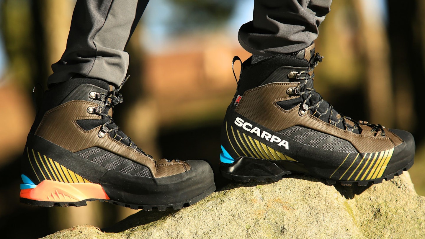
Here's a selection of the best walking gear selected by LFTO's testing team: Walking boots | Hiking daypack | Waterproof jacket | Walking trousers | Walking poles | Walking mid-layers | Base layers
Where can I eat and drink?
The Tongue Hotel for its great local food.
Where's the best place to stay?
Tongue Hostel and basic camping, www.tonguehostelandholidaypark.co.uk
The Tongue Hotel, www.tonguehotel.co.uk
Ben Loyal Hotel, www.benloyal.co.uk
About the author
Kirstie Shirra is a freelance writer and environmental campaigner who has contributed to Trail magazine and LFTO for many years. She's been climbing mountains since she could walk and has traveled the world looking for great places to walk and hike, but her heart belongs in north-west Scotland where she lives with her family.
This route originally appeared in the June 2017 issue of Trail magazine. CLICK HERE to become a Trail magazine subscriber and get 50% off a whole year of digital OS Maps
