
The great expanse of Scotland poses the challenge of there being too much choice for hikers! To make things easier, many hone their focus on the list of distinct summits above 3000ft – the famous ‘Munro’s Tables’ identified by Sir Hugh Munro in 1891.
And this particular walk from Glenfinnan Viaduct, at the northern end of Loch Sheil, enjoys a logical horseshoe route encompassing two characterful Munro peaks, as well as three more summits – all offering some of, perhaps, the finest views in Scotland.
This route, which originally appeared in Trail magazine, could be followed as described (anti-clockwise – providing a shorter, more direct ascent) or reverse the route if wind direction/strength play a factor in your planning.

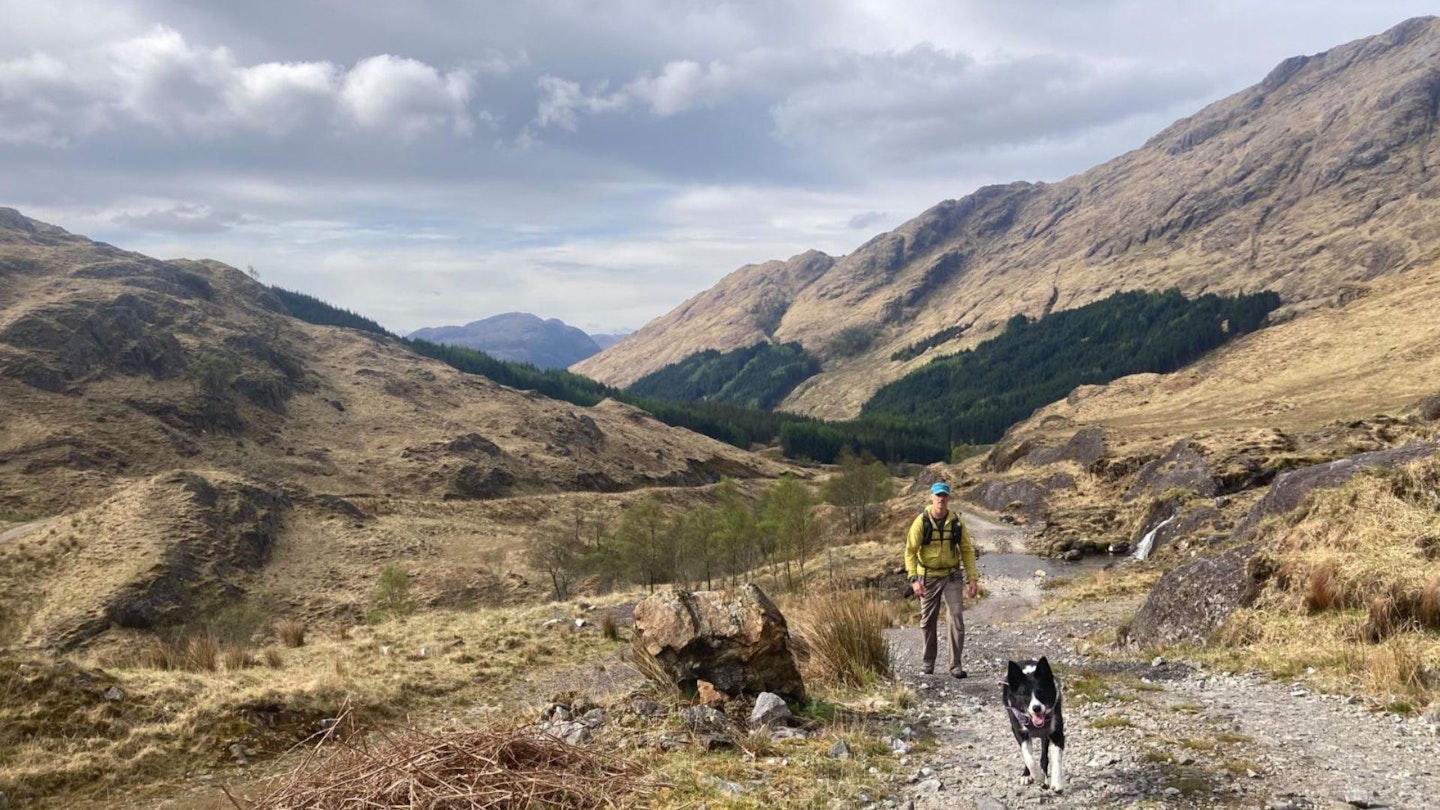
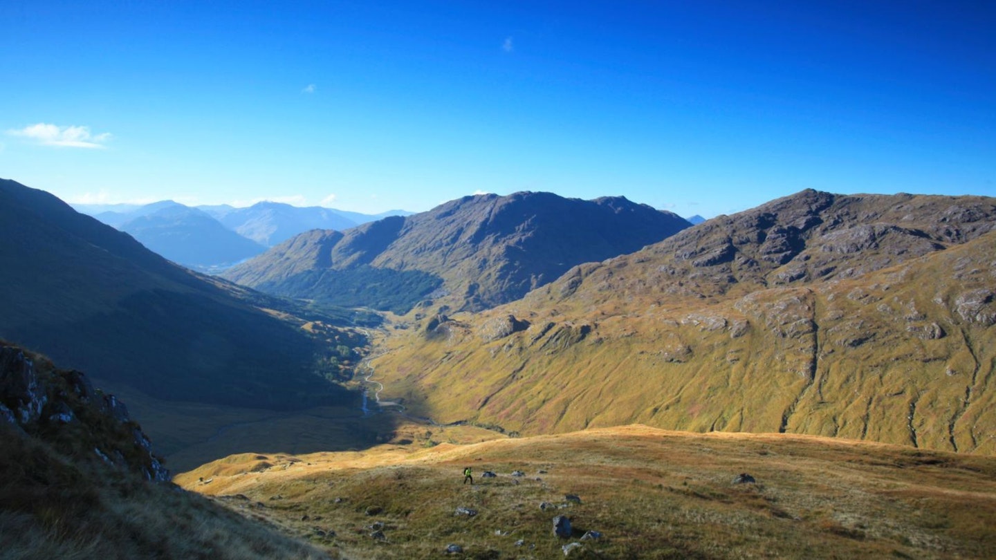
This route offers a fabulous outing for experienced walkers, who might be new to Scotland. It manages to mix in some classic hallmarks of a grand day out in the West Highlands: sweeping glens, a meandering river, classic mountain bothy, rugged ground, imposing rocky architecture, views over distant sea and islands, native trees and forested slopes, estate tracks and trails, and both natural and human history.
It’s all here – an easy walk or bike ride away from the main road – making these rugged and dramatic slopes just a tad more accessible.
How hard is climbing the Glenfinnan Munros?
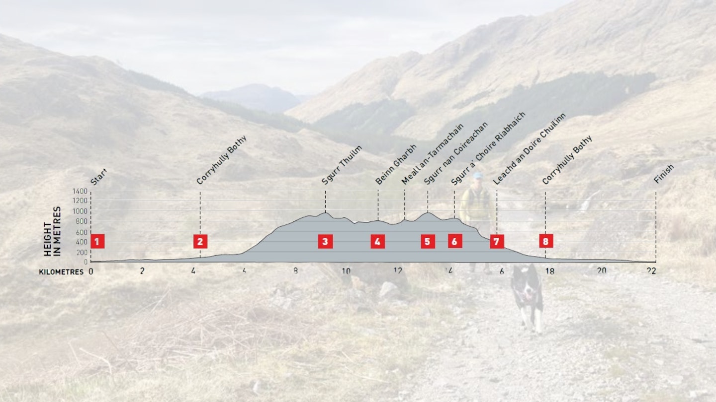
DIFFICULTY: Hard | DISTANCE: 22.2km | TIME: 9 hours | TOTAL ASCENT: 1420m
FITNESS: A very good level of hill fitness is required, including being comfortable on a few steeper slopes/rocky steps at times, and accumulating a significant amount of ascent over the course of the day.
TERRAIN: Grassy and rocky mountain shapes, a ridgeline with notable summit points; these Munro hills offer a wonderful horseshoe route.
NAVIGATION: Mostly obvious mountain routes, including stalkers’ path on descent. Ridgeline route follows large hills and boundary line/fence. In poor visibility, use map and compass for descent route from Sgurr nan Coireachan.
Where is the start of the walk?
Bus 500 and ‘Harry Potter’ train options from Fort William (Sheil Buses). Pay & Display parking at Glenfinnan Monument Visitor Centre.
What's the best map for Glenfinnan Munros?
-
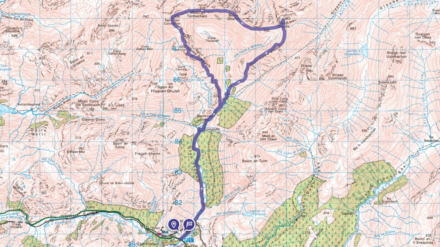
CLICK HERE to view and download our digital route guide in OS Maps
Glenfinnan Munros | Step-by-step route guide
-
You may have accessed the start of this route by car or bus, but it’s worth orientating yourself at the large National Trust for Scotland Visitor Centre car park (toilets/cafe) first. The estate track required can be gained by either using the main road to cross the River Finnan and locate the gated track, just after the bridge. Or an engineered path can be used on the east side of the river, which starts from the car park and meanders towards a bridge at NM909813. Your choice of covering the next 4km on bike or foot may influence your decision, as it’s easier to cycle on the tarmac track, on the west side of river. Easy walking alongside the river, introduces you to Glen Finnan quite sedately!
-
Arrive at Corryhully Bothy and a junction of streams. This is a good place to orientate the map, safely store bikes (if used) and prepare for the day’s walk. Depart this area by way of the continuation of this good estate track, as it starts to ascend towards another stream junction (waters descending from Coire Thollaidh to the north). Cross a bridge at the base of a major spur – Drum Coire a Bheithe – leading towards the summit of Sgurr Thuilm. Start the gradual ascent, steeply on grass at first, and enjoy the unfolding mountainous panorama in all directions as height is gained. Walking is steadier above the 700m contour and a faint path follows the shoulder to the base of the final ascent to Sgurr Thuilm. At the 900m contour, head directly north for 350m and reach your first summit of the day.
-
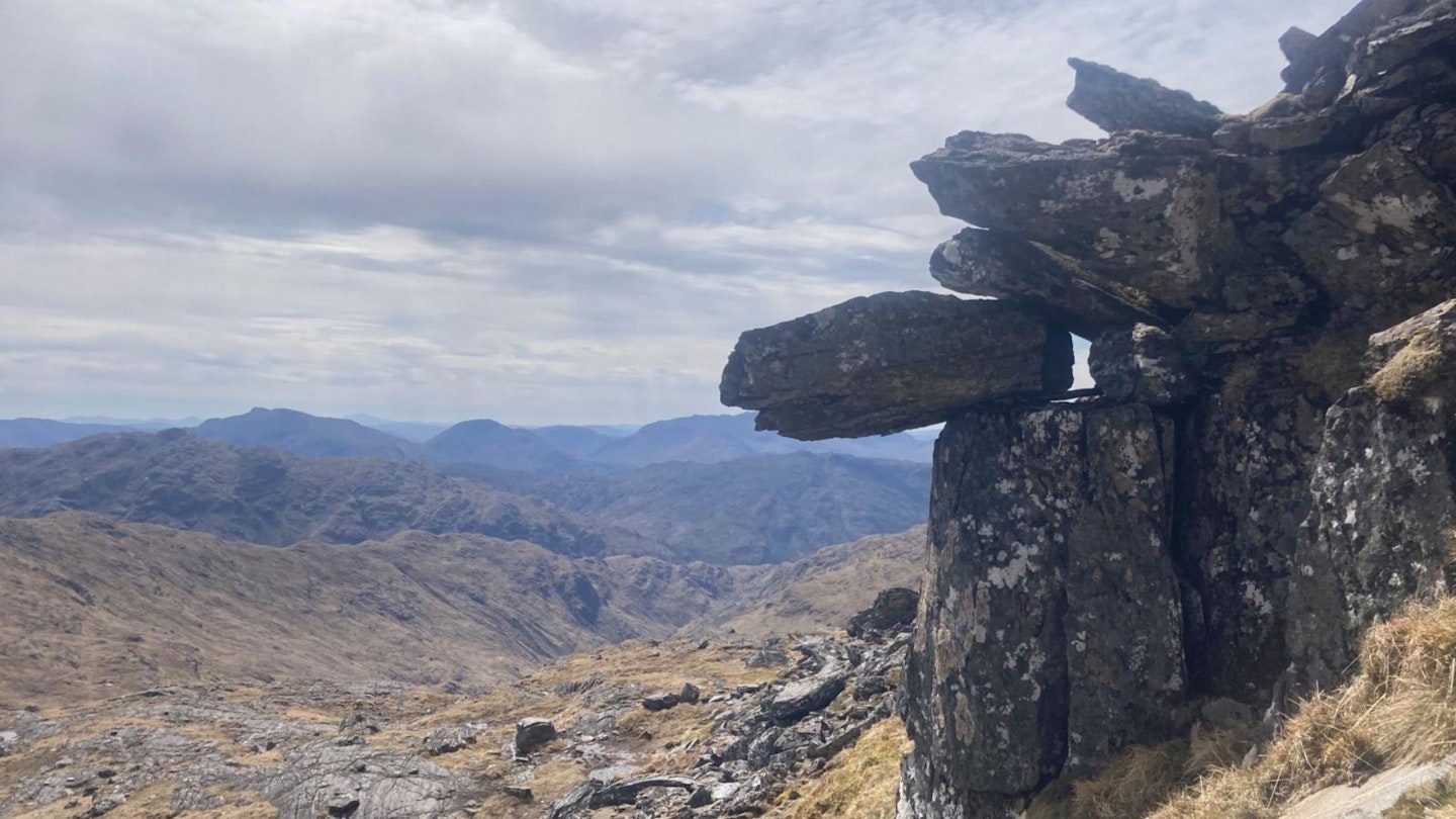
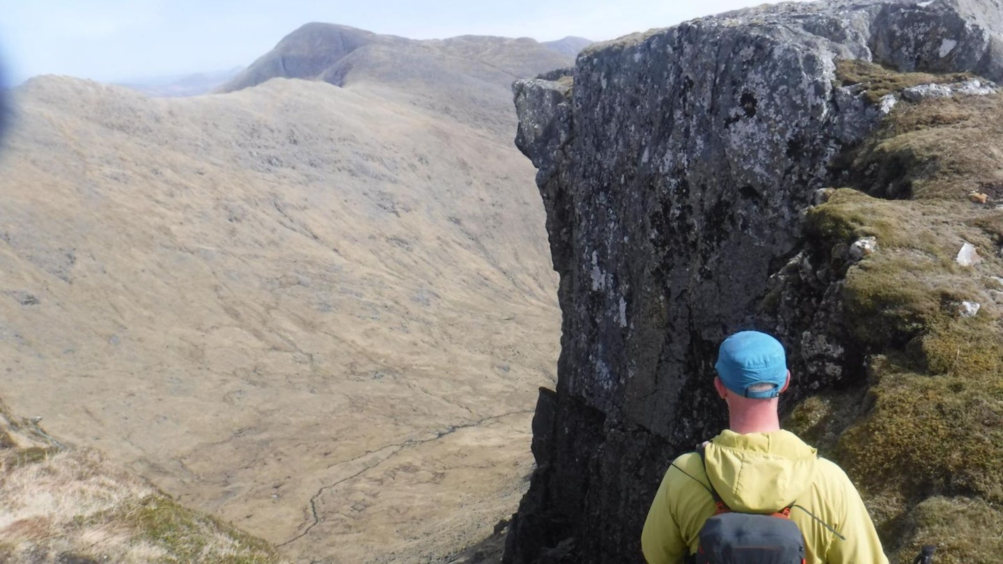
From this rounded summit, if the weather is clear, catch glimpses of distant peaks in all directions, including east to Ben Nevis and north-west to the Knoydart peninsula, as well as the continuation of the route around the undulating head of Coire Thollaidh. In poor visibility, check a compass to descend just south of south-west to the 850m contour and meet an old boundary/estate line, with rusty posts still in place – which can provide handy features to locate if needed. Once on the rocky and grassy ridge connecting a number of lower summits, enjoy walking generally west/ north-west towards the next significant summit of Beinn Gharbh (825m high and about 2km away), gaining and losing height over rocky and grassy ground. If strong winds from the west are forecast, it may be more comfortable reversing this route as, although it’s a glorious ridge walk, it’s high and can feel exposed in poor weather.
-
From Beinn Gharbh, the final and highest summit of the day, Sgurr nan Coireachan, looks quite imposing, rising to the west. Follow the remaining ridge line for 2km as it sweeps round to the final ascent of Sgurr nan Coireachan, where the ground steepens after the 850m contour. Here the route heads south-west to ascend broken and steeper ground, with some rocky steps to clamber through to gain the summit trig point at 956m.
-
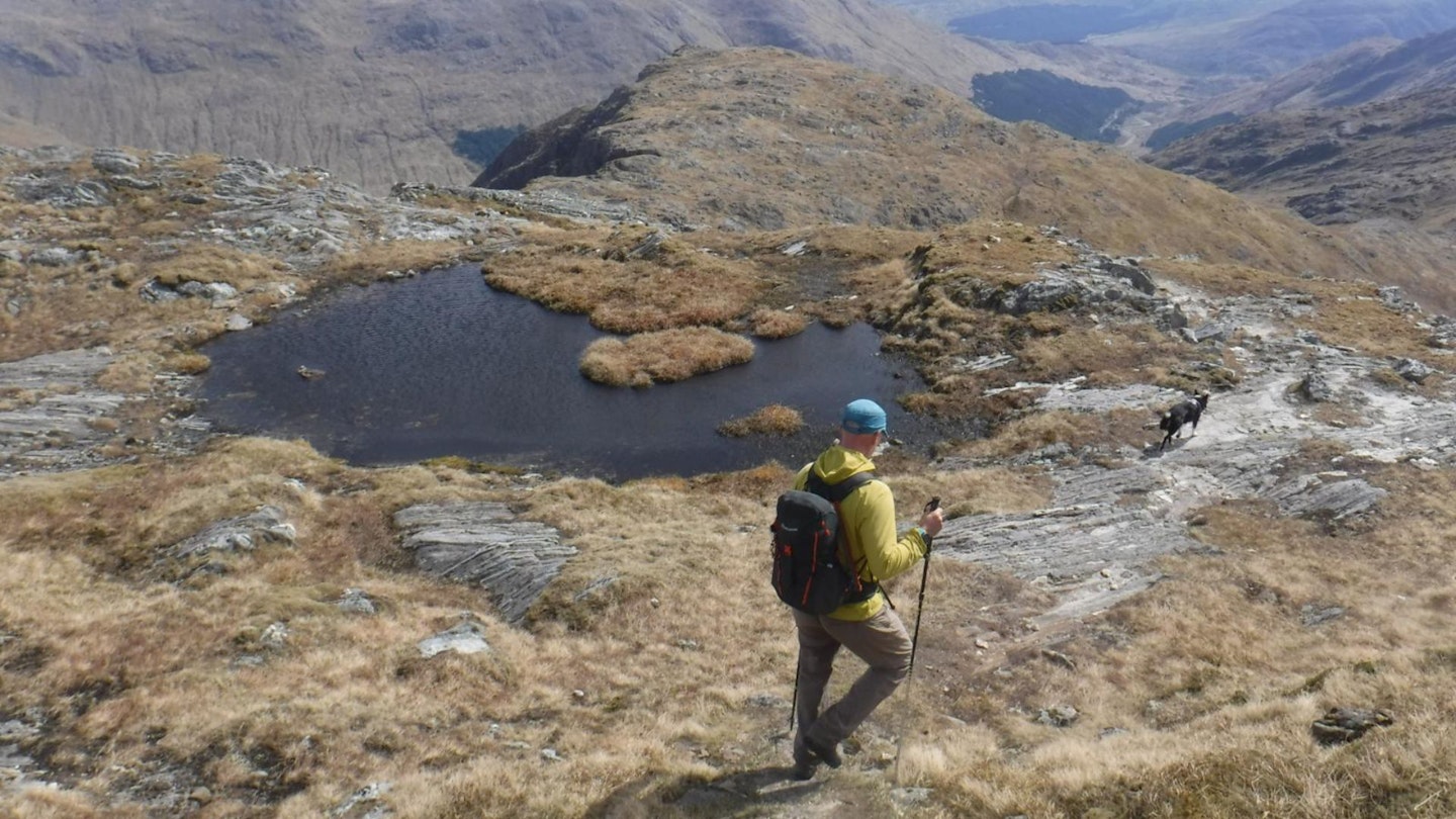
Enjoy magnificent views out to sea and, on clear days, of the Small Isles and the Isle of Skye from this summit. An abrupt change of direction to descend south-south-east brings another perspective over Coire Thollaidh and summits to the east, including the very sharp and shapely Corbett, Streap, on the opposite side of Glen Finnan. The next 1km of descent follows some steep sections of path, rocks and vague/rocky ground towards the lower summit of Sgurr a’ Choire Riabhaich. Handrailing the edge of the ridge line, keeping steeper slopes on the left down to the coire below, is a useful navigational tool here – especially when crossing the flatter area between the two summits. The route is vague, especially in poor visibility, as it moves through rocks and peaty ground. Gain height slightly again to 852m to reach the flat summit area, prior to another steep descent.
-
From the rounded top of Sgurr a’ Choire Riabhaich, head south-east for 200m towards steeper slopes, looking for a distinct zigzag switching south west to descend through steeper ground to the shoulder below. The route now follows a prominent shoulder to the east of Coire Carnaig and an intermittent path is helpful at times. But the general direction keeps heading south-east, eventually dropping to the junction of rivers at the foot of Coire Thollaidh. At around the 350m contour, keep a look out for a much more evident track that develops, initially heading east to start descending to the glen below.
-
Locate the track at this grid reference and enjoy a fairly straightforward descent. It is the route of a well-used and historical stalkers’ path, also previously used by horses. It heads down, generally south across steep hillside, for almost 1km and meets up with the main track through the glen, that was used in the outward ascent. Enjoy the easy walking on this track for 1km back to Corryhully Bothy.
-
Now there is the return leg, along 4km of estate track/tarmac, heading generally south-west towards the Glenfinnan Viaduct and Visitor Centre. Enjoy the easy walk by the river or collect bikes to cycle back to reality.
What walking gear do I need for this route?
Here's a selection of the best walking gear selected by LFTO's testing team: Walking boots | Hiking daypack | Waterproof jacket | Walking trousers | Walking poles | Walking mid-layers | Base layers
Where can I eat and drink?
Glenfinnan Monument Visitor Café (10am-4pm daily) or walk a little way to the Prince’s House Hotelfor bistro/bar food – check availability.
Where's the best place to stay?

Super ethical ‘eco tiny houses’ at Back Track Bothies, Glenfinnan or find more space at Craigag B&B, only 1 mile from Glenfinnan.
About the author
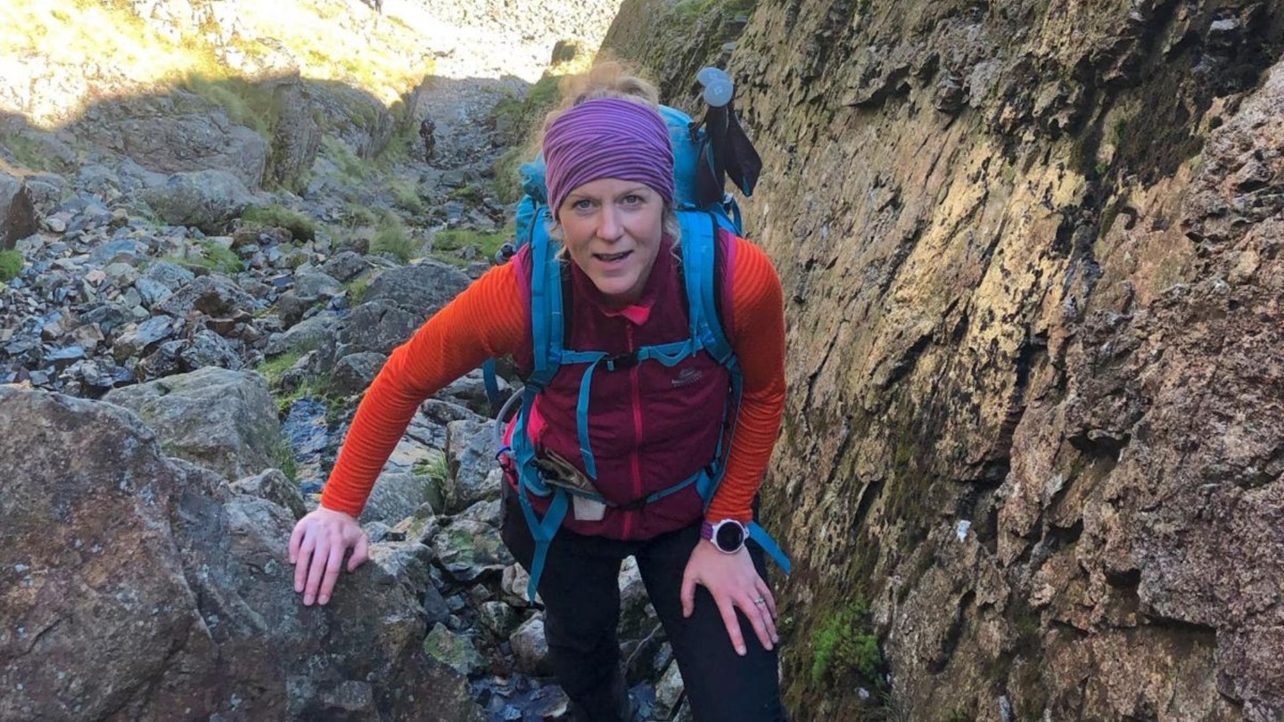
Kate Worthington lives and works in the mountains of north Wales, where she's a director of RAW Adventures, plus a qualified Mountain Leader, Winter Mountain Leader and Fell/Trail Leader in Running Fitness. Kate has been hiking, climbing, scrambling and running in the mountains her whole life.
This route originally appeared in the November 2024 issue of Trail magazine. CLICK HERE to become a Trail magazine subscriber and get 50% off a whole year of digital OS Maps.