
If you want to turn an easy summit into a stamina test in the remote and otherworldly Duddon Valley, then take this quiet but view-packed route up the Lake District's Harter Fell.
Don’t be fooled by Harter Fell’s stature. The map will try to tell you this is a small, isolated bump; a short, sharp climb with a lovely riverside stroll to finish, and plenty of forestry to keep you cool on those hot summer days.
Well, the problem with isolated bumps is they tend to have steep slopes on most sides; and as for riverside strolls in wooded mountain gorges – just picture centuries-worth of rockfall choking up the valley bottom, and the kind of obstacle-ridden progress afforded by felled forestry and numerous bogs.
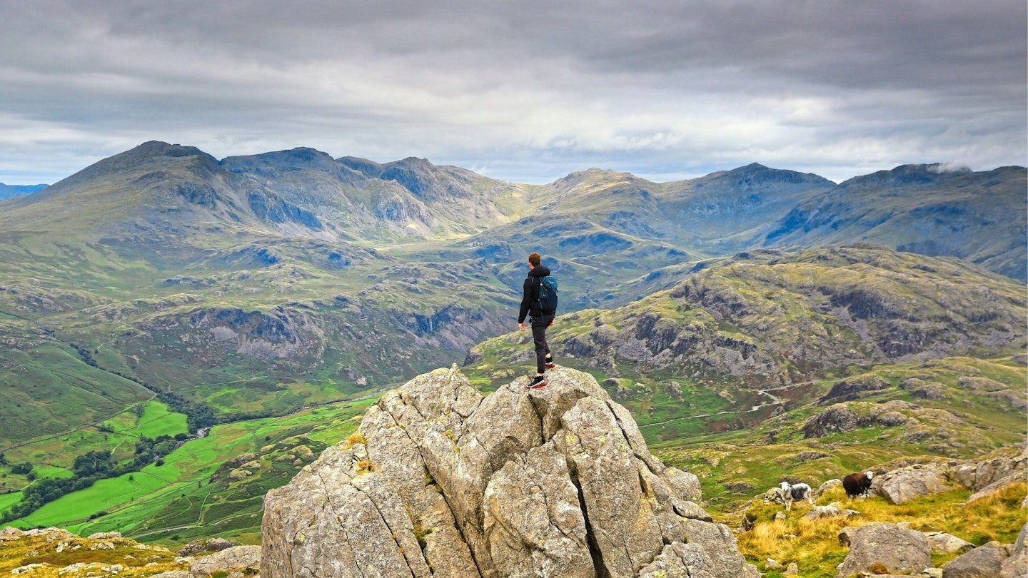
So why choose this route? Because the views over the fells and seas are immense. Because the Duddon Valley is so beautiful – and Wallowbarrow Gorge so dramatic – that it feels more like Middle Earth than the Lakes.
And because, ultimately, it transforms this small, lesser-known Wainwright into a challenge, with a capital C. While also delivering possibly the best views into Scafell Pike, Bow Fell, Crinkle Crags, and all of Eskdale's star names. Isn’t that what we hillwalkers thrive on?
How long is the Harter Fell walk?
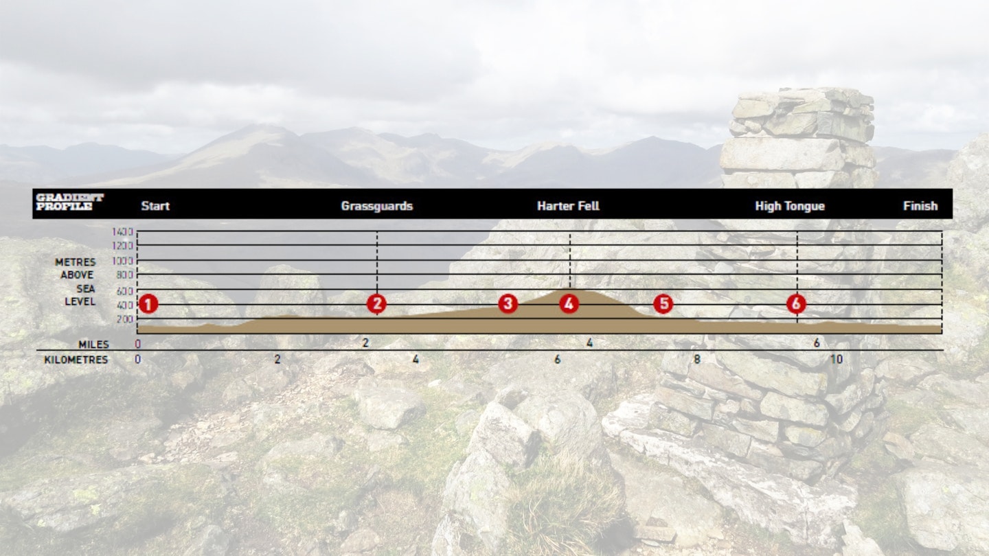
DIFFICULTY: Medium | DISTANCE: 11.5km (7 miles) | TIME: 5 hours | TOTAL ASCENT: 700m
FITNESS: Not a particularly challenging mountain walk by Lake District standards, with moderate asecent and descent.
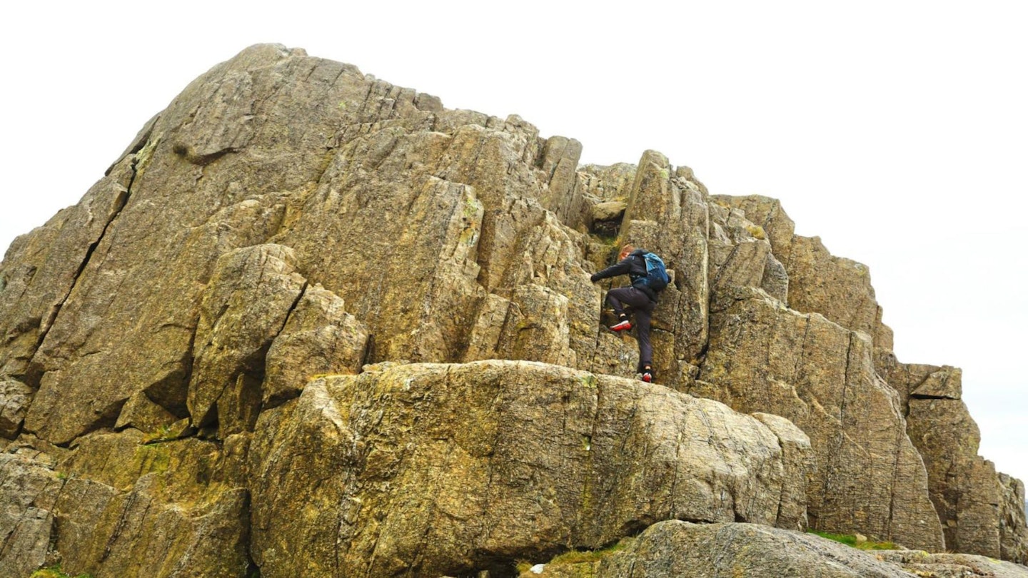
TERRAIN: Some steep climbs and a very steep, loose descent, but no scrambling. Felled forestry and rocky/boggy areas slow down the river section; with wet sections throughout.
NAVIGATION: Harter Fell isn't the most obvious peak to follow paths on. If visibility is good you'll have few issues, but carry a map and compass and know how to use them if the cloud descends.
Where is the start of the walk?
Seathwaite Village Hall. The nearest town is Broughton-in-Furness, Cumbria.
What's the best map for Harter Fell & Wallowbarrow Gorge?
-
CLICK HERE to view and download our digital route guide in OS Maps
Harter Fell & Wallowbarrow Gorge | Step-by-step route guide
-
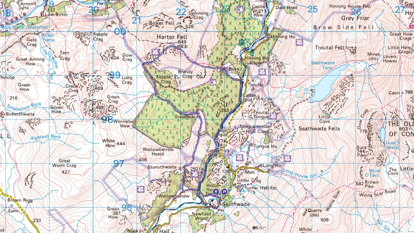
Head south, then past the pub, to a waymarked path opposite School House. Cross the bridge and take the wider path through woods and riverside. Cross a packhorse bridge, and head slightly left on to the main path into farmland. Continue through the top of the farm before ascending, more steeply below Wallowbarrow Crag. This becomes a good track towards Grassguards, where a permissive path cuts left around the buildings, emerging through a gate back on to the bridleway.
-
Turn left; the path crosses a forestry track then gradually ascends through open hillside which becomes rougher and wetter towards the remaining forestry. Great views of the Coniston range are currently clear and open, but the extensive felling is part of a decades-long project to restore the landscape with broadleaf woodland and bogs, improving habitats and reducing flooding. Go left at the bridleway junction, now in trees, and through a gate at the end of the forest.
-
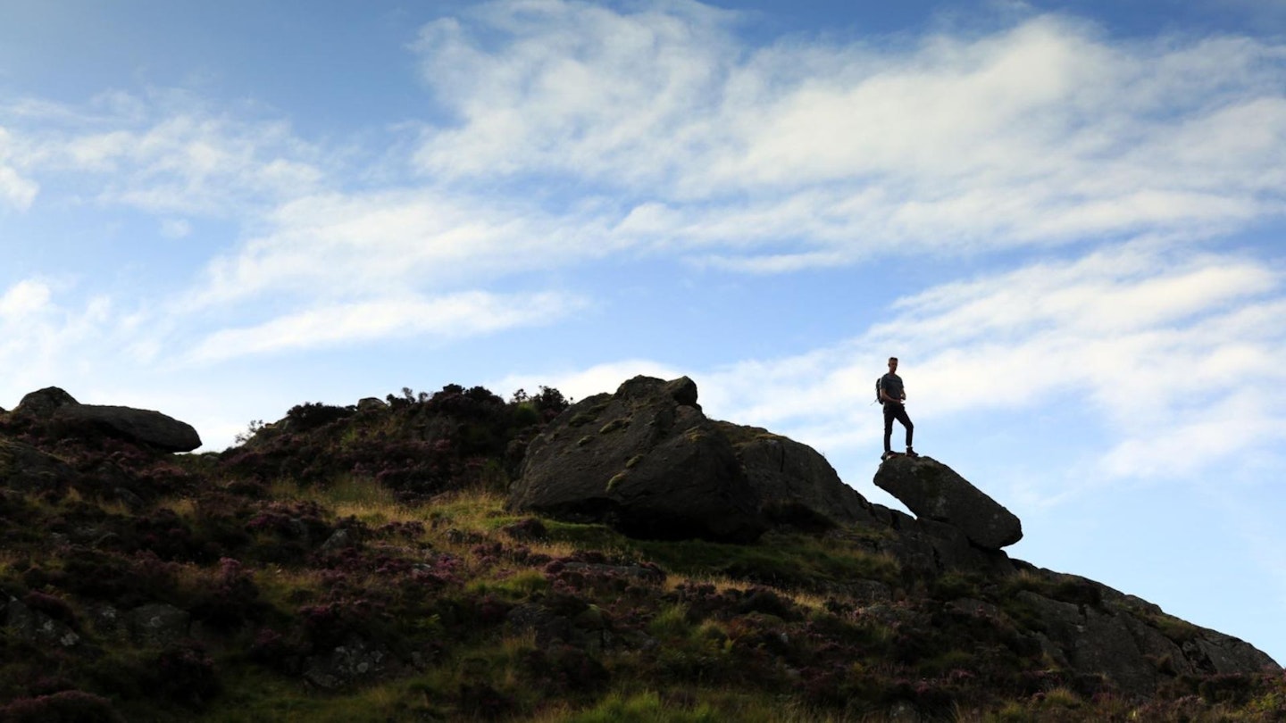
Take a steep right up this fence then veer slightly right from its top corner. Stick to this vague, grassy path as it twists around rocks and crags in a generally north-easterly, and definitely uphill, direction. Keep left of a large crag which turns out to be a false summit, and pass a small path junction cairn as you get close to the true summit.
-
Shortly afterwards, the grassy path levels, forms a mini col between a jumble of rocks and crags on the left and a vertical crag on the right. A faint track left behind the first of the ‘jumbles’ takes you to the initially hidden trig point.
-
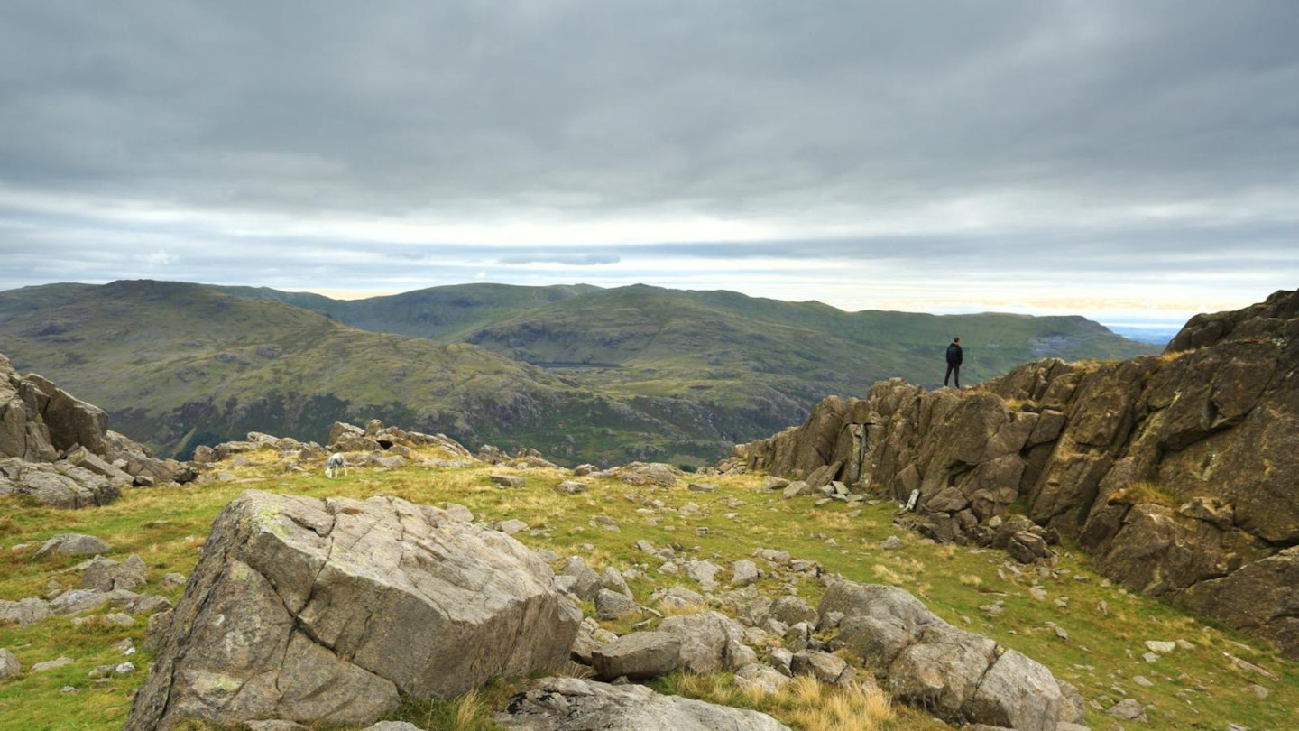
The stunning Cumbrian coast and Duddon Estuary stretch out below you with, if you’re lucky, Snowdonia and the Isle of Man beyond. Behind, commanding views of the Scafell and Bowfell ranges prove you don’t always need to summit the highest tops for a mountain fix.
-
Return to the main path and retrace your steps towards, but not as far as, the small cairn you passed on ascent. Instead, look for an easier grassy line doubling back to the left below the summit crags, then continuing as a faint south-easterly track down to the left of Maiden Castle (a prominent rocky knoll) and eventually a gate. From here it’s particularly steep, stony and gravelly, so careful footing is required. Eventually you’ll drop down to Birks, a remote outdoor education centre.
-
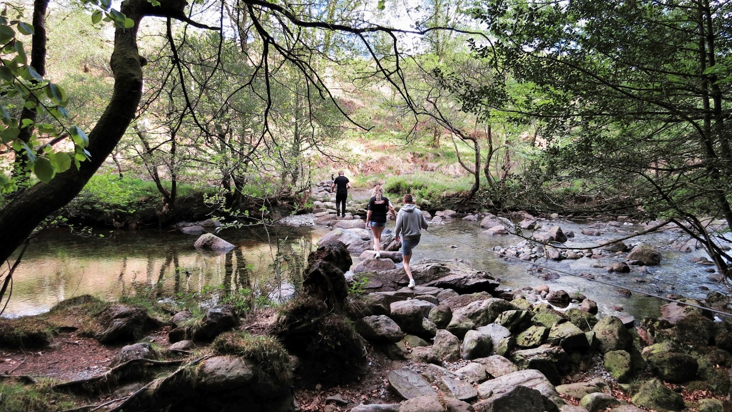
Stay this side of the building; a subtle waymark directs you along its wall, right, to a stile in a fence. Cross it and follow a vague line down the field to a stile in its far right corner which leads to woods then riverside. Turn right, heading downstream, emerging from trees on a rough and boggy desire line [see page 59]. Eventually the riverside ‘path’ disappears between rock and water: if you hit this point, retrace your steps slightly and forge your way up through felled trees towards the remaining forestry, where the track reappears and waymarks set you back on your way. Continue to some haphazard stepping stones (or boulders!) with a wire handrail.
-
Keep this side of the river, then over a footbridge and uphill through the woods. The path drops you back down to the base of Wallowbarrow Crag’s dramatic boulder field and the River Duddon. Eventually the packhorse bridge from earlier appears: cross and, for variety, keep straight ahead through the woods emerging over a footbridge into a field. Go right for the pub, or left along a stream to emerge just north of the village hall.
What walking gear do I need for this route?
Here's a selection of the best walking gear selected by LFTO's testing team: Walking boots | Hiking daypack | Waterproof jacket | Walking trousers | Walking poles | Walking mid-layers | Base layers
Where can I eat and drink?
- The Newfield Inn, Seathwaite, www.newfieldinn.co.uk
Where's the best place to stay?
- Seathwaite Lodge holiday cottage, www.seathwaitelodge.co.uk
- Turner Hall campsite, turnerhallcampsite.co.uk
- High Wallabarrow bunkhouse, camping barn & holiday cottage, www.wallabarrow.co.uk
About the author
Ange Harker grew up in Nidderdale, North Yorkshire, and has been passionate about walking her entire life. She's a regular route guide writer for Trail magazine, and is also a qualified Hill and Moorland Leader.
This route originally appeared in the September 2017 issue of Trail magazine. CLICK HERE to become a Trail magazine subscriber and get 50% off a whole year of digital OS Maps