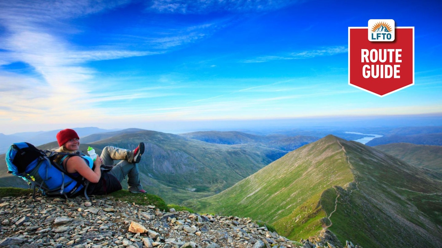
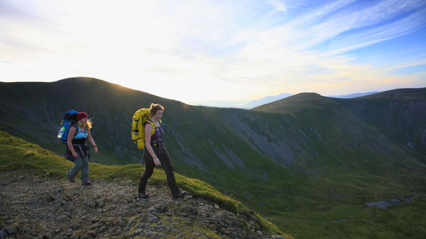
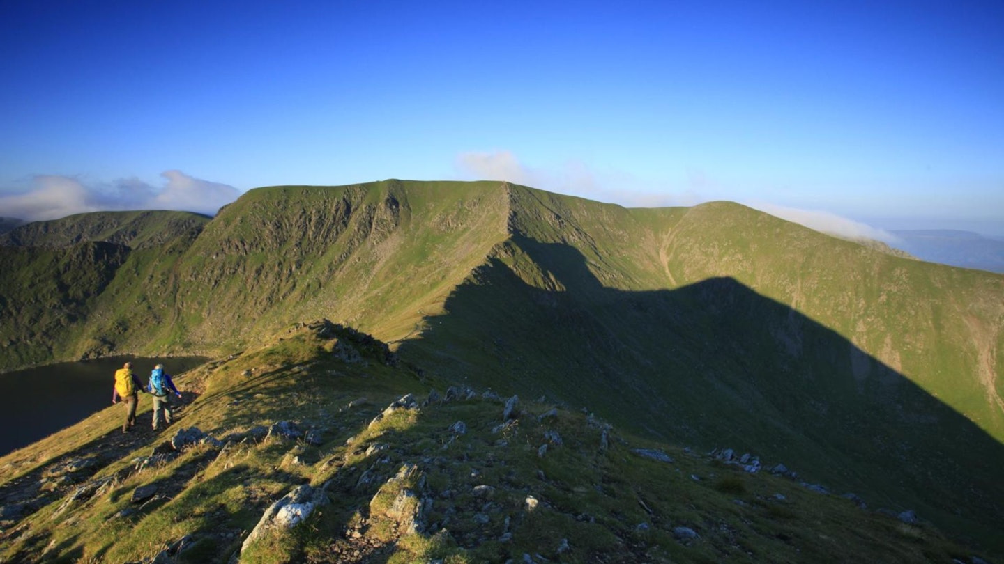
I’m a bit of a scaredy cat when it comes to exposure while scrambling (and no, I’m not talking about mooning on crags). So the fact that I absolutely adore hauling myself up Swirral Edge – one of the two arêtes that cradle Red Tarn on Helvellyn’s east face – suggests to me that it’s the perfect starting point for hillwalkers who want to get to grips, literally, with rock, but are wary of finding themselves dangling over a dark abyss.
By first climbing Catstye Cam, with its ever so slightly exposed peak, this walk allows you to build confidence on a moderately narrow ridge before tackling the arête itself. There are trails that bypass the crest in places, but you’ll have to take your hands out of your pockets eventually.
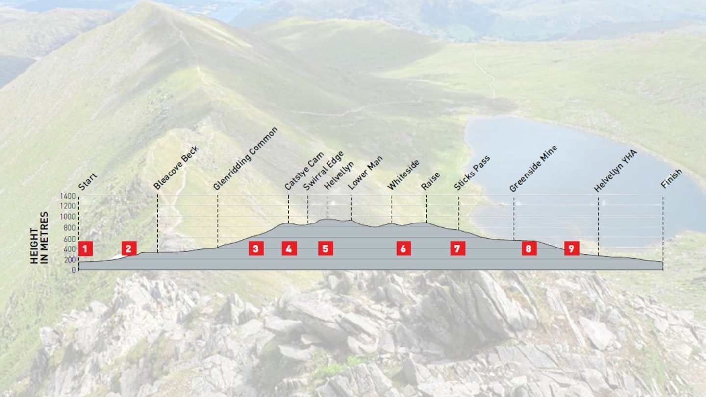
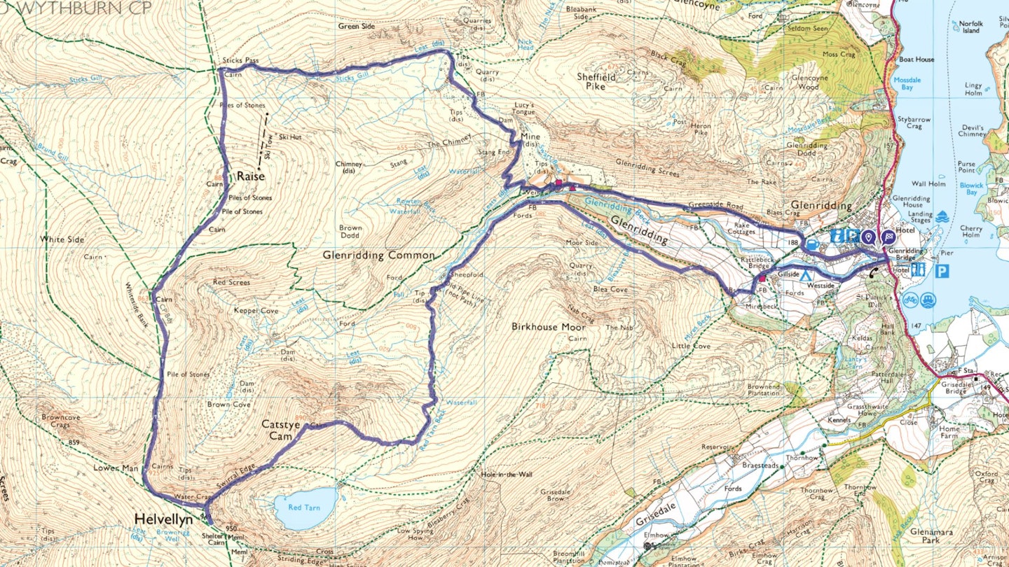
From the summit of Helvellyn, the walk descends the steep Lower Man ridge to White Side. The now broad ridge then continues to Raise and finally leaves the high fells via Sticks Pass.
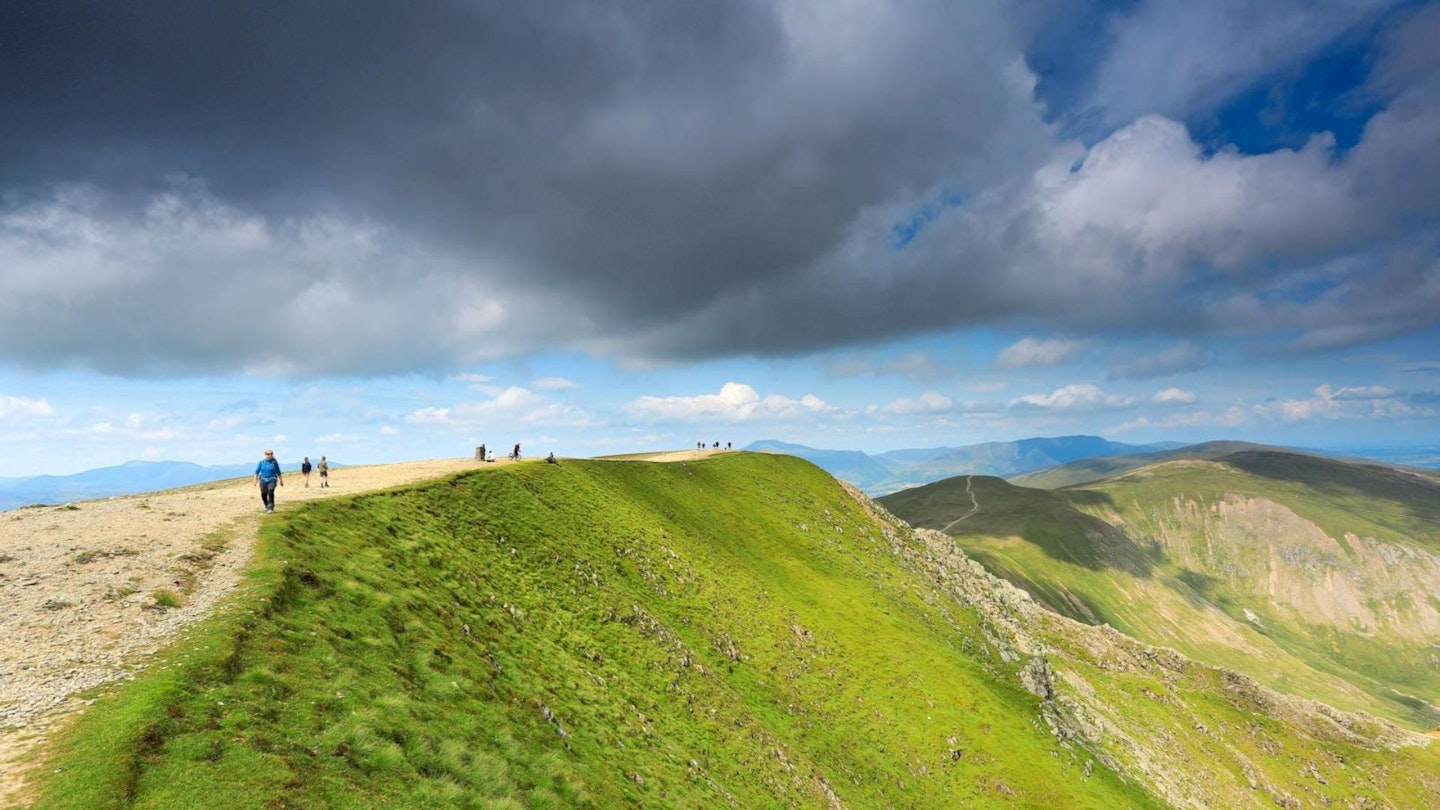
The day isn’t over yet though – a hanging valley, a rare juniper forest and the remains of what was one of the country’s busiest lead mines are all encountered on the return to Glenridding. The beauty of this route is it's arguably one of the finest mountain routes in the Lake District, yet still avoids the larger crowds you'll see across Red Tarn on Striding Edge. Read on for our step-by-step guide on how to walk it.
How hard is climbing Helvellyn via Swirral Edge?
DIFFICULTY: Hard (Grade 1 scramble) | DISTANCE: 16.4km | TIME: 6.5 hours | TOTAL ASCENT: 1,034M
FITNESS: Decent level of fitness required for steep ascent of Catstye Cam and scrambling on Swirral Edge.
TERRAIN: Mostly well-used fell paths with a combination of grass, stony ground and rock; arête with mild exposure; exit from arête on scree.
NAVIGATION: Start of path on to Catstye Cam is unclear, and there’s potential to take wrong route off Helvellyn’s summit.
Where is the start of the walk?
Start from Lake District National Park car park in Glenridding, which can be reached by bus 508, Penrith to Patterdale (to Windermere in summer).
What's the best map for Helvellyn via Swirral Edge?
-
CLICK HERE to view and download our digital route guide in OS Maps
-
OS Explorer OL5 (1:25k)
-
OS Landranger 90 (1:50k)
-
Harvey Superwalker XT25 Lake District North or Lake District East (1:25k)
Helvellyn via Swirral Edge | Step-by-step route guide
-
Leave the car park, walk to the main road and turn right. Turn right again along a surfaced lane immediately after the bridge over Glenridding Beck. Beyond the last building, bear right at a fork. Reaching a minor road, turn left and, almost immediately, step up on to the gravel path to the right. This joins a wider track heading uphill. At a path junction at a gate, keep left. In another 110m, bear right at a fork.
-
After a gate, turn right to walk with the wall on your right for 320m and then bear left at a fork, climbing again. After a stony section, reach a crossing of routes. Turn right here, contouring the hillside for the next 1km. After drawing level with the Greenside mine buildings on the other side of the valley, you’ll see a footbridge to the right. Ignoring this, bear left, climbing a pitched path. A long, slow uphill plod begins now, the view of Catstye Cam providing motivation at this stage.
-
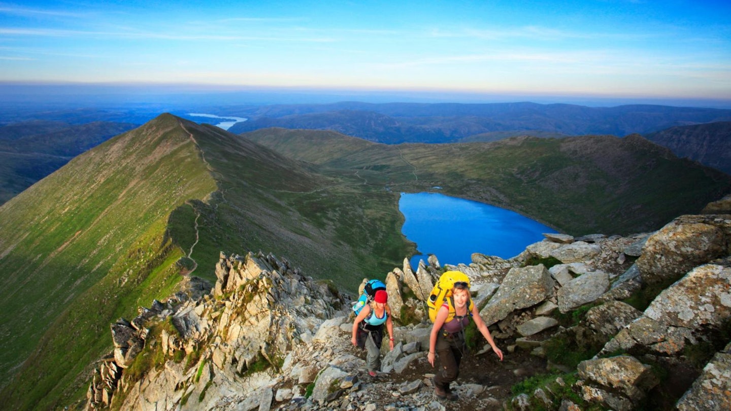
About 1.3km after crossing two wooden footbridges in quick succession, leave the path by striking off west-north-west along a broad, lumpy ridge. There is a faint, grassy trail, but it’s hard to find; you should, however, be able to locate a more eroded, stonier path higher up. As you climb, Red Tarn and Striding Edge – Swirral Edge’s partner in crime – come into view.
-
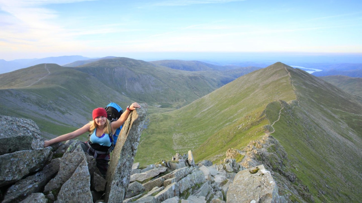
From Catstye Cam’s spiky summit, follow the ridge path south-west, keeping right when it forks. A path joins from the left and the ridge begins narrowing. This is now Swirral Edge. The first rocky section can be avoided on a bypass path to the south, but the scrambling can’t be avoided forever. The next tower has to be tackled head on, with hands on rock. The loose, stony exit from the ridge rises to a cairn. Head left to reach Helvellyn’s trig pillar and the true summit 100m further south-east.
-
Return to the trig pillar and continue heading north-west. passing the point where About 350m beyond the point where you joined Helvellyn’s summit plateau from Swirral Edge, bear right, staying close to the high ground’s eastern edge. Beyond the top of Lower Man, the path descends steeply. It drops into a dip, climbs Whiteside and then drops into another dip above Keppel Cove.
-
Keep left at a fork in this second saddle to climb Raise. From the summit cairn, a stony path descends north. It levels off, reaching a path junction at Sticks Pass.
-
Turn right, soon descending with Sticks Gill. Nearing the bottom of the valley, keep right at a faint fork and then, at a second split among some spoil heaps, keep right again, following a cairned route. This winds its way through disused mine workings and crosses Swart Beck.
-
Bear left, not on the beckside trail but on a path about 35m south of the beck. After a sharp bend to the right, it begins a switchback descent of steep, stony ground. (Ignore a narrower path to the left on an early bend.) Nearing the valley bottom, bear left at a junction marked by a waymarker post.
-
Dropping to a broader track, continue downhill, past the buildings of the old Greenside Mine. The track now becomes driveable. It later bends right at a 30mph speed limit sign and then swings left, entering Glenridding. Immediately after passing the Fairlight Guesthouse, turn right to re-enter the car park.
Where can I eat and drink?
Several pubs and cafés can be found in Glenridding, including the recently reopened Ullswater Inn which serves breakfast, lunch and dinner.
Where's the best place to stay?
YHA Helvellyn, located at almost 300m above sea-level, is passed towards the end of the walk, but for longer stays there are plenty of B&Bs, plus the mountain town of Kendal, which offers many more options, is not too far away.
About the author
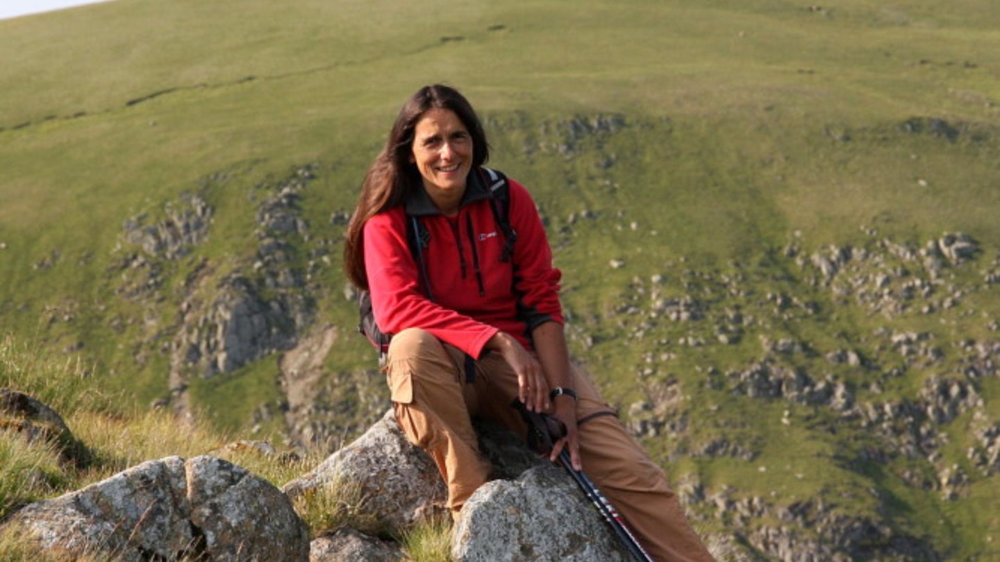
Vivienne Crow is an award-winning outdoor writer and photographer with an all-consuming love of walking and the natural world. Vivienne specialises in all things to do with the Lake District and Cumbria, her adopted home county, but travels far and wide in her camper van, writing about walks, destinations, natural history and human heritage throughout the British Isles – often with her terrier Jess in tow.
This route originally appeared in the July 2024 issue of Trail magazine. CLICK HERE to become a Trail magazine subscriber and get 50% off a whole year of digital OS Maps