Nestled within the picturesque Lake District fells, and known as the High Stile Range, the four Wainwrights of Red Pike, Haystacks, High Stile, and High Crag stand as a testament to the breathtaking beauty of England’s northern landscapes. And they combine to create a truly memorable hillwalk.
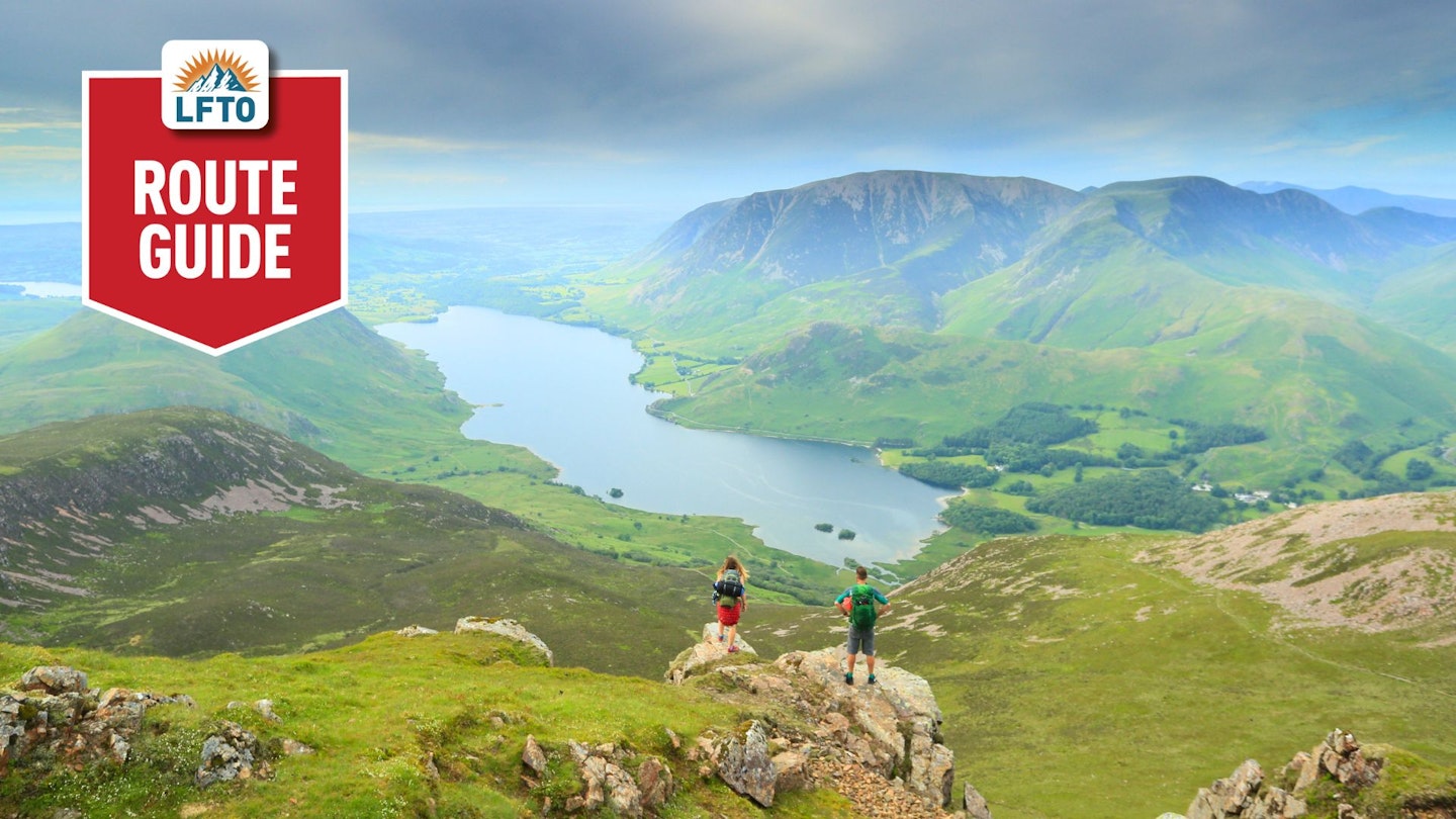
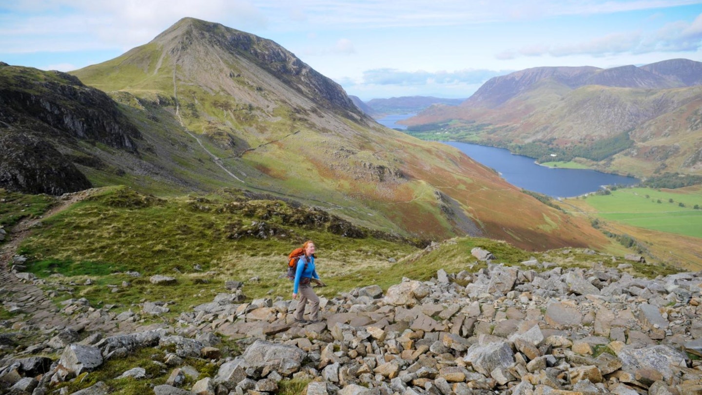
Red Pike, with its commanding presence, provides panoramic views of Buttermere and Crummock Water. A journey to its summit reveals a rugged terrain and a sense of accomplishment that resonates with every step.
Haystacks, famously beloved by local guidebook author Alfred Wainwright, boasts an unassuming charm. Its rolling ridges and hidden tarns create an enchanting setting, making it a must-visit for those seeking tranquillity amidst the peaks. High Stile and High Crag stand as formidable neighbours, offering challenging ascents and rewarding vistas.
This quartet forms a harmonious symphony of nature’s grandeur. Each summit is a unique chapter in the Lake District’s story, inviting explorers to uncover the secrets of its craggy peaks and serene valleys. Whether a seasoned hiker or a first-time adventurer, the allure of Red Pike, Haystacks, High Stile, and High Crag promises an unforgettable journey through the heart of England’s stunning wilderness.
How hard is climbing The High Stile Range?
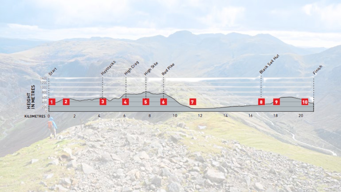
DIFFICULTY: Hard | DISTANCE: 21km | TIME: 8 -10 hours | TOTAL ASCENT: 1,350m
FITNESS: Endurance needed, as it’s a long day with lots of height gain.
TERRAIN: A good mix of steep ascents and descents, craggy areas and rocky terrain.
NAVIGATION: You need good navigation skills in poor visibility, but on a clear day it’s a reasonably straight route of multiple summit stops.
Where is the start of the walk?
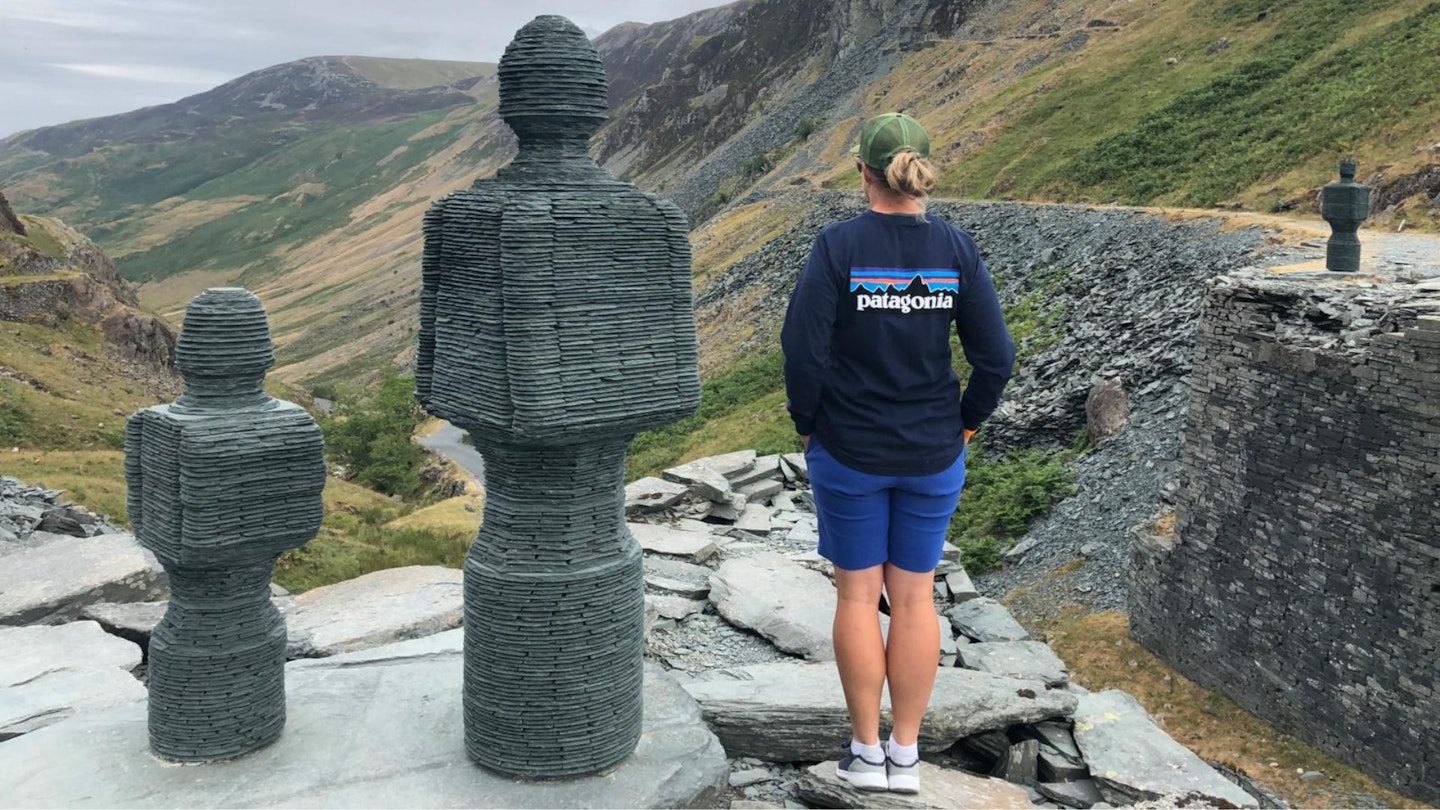
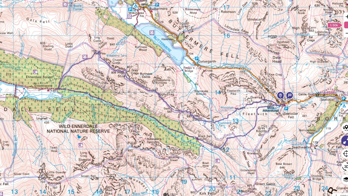
The route starts at Honister Slate Mine. The car park costs £5 (at time of writing) for non-customers and also offers overnight parking for £15 per night.
What's the best map for climbing the High Stile range?
-
CLICK HERE to view and download our digital route guide in OS Maps
-
OS Explorer OL4 (1:25k)
-
OS Landranger 89 (1:50k)
-
Harvey British Mountain Map XT40 Lake District (1:40k)
High Stile Range | Step-by-step route guide
-
From Honister Slate mine, take the path heading west up Bell Crags. It’s a relatively steep ascent with loose rocks but easy to navigate here. The path eventually flattens around piles of loose chippings.
-
Further along the path, you’ll see an old rusty shack half buried in the slate. And Dubs Hut, a cute little bothy you can enter. Follow the path left at the junction and begin ascending after the stream crossing. Keep uphill over the craggy terrain as you pass Innominate Tarn to your left.
-
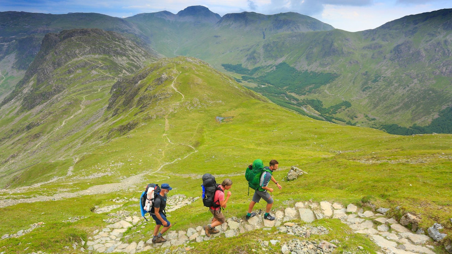
As you reach the summit of Haystacks, be sure to look around on a clear day. There is a cute tarn at the top. The descent is quite steep and drops into a saddle before ascending over the path junction. Keep west up the sharp ascent over Seat (not a Wainwright). The footpath continues along and up to High Crag.
-
Take a breather after reaching the top. It was steep! Follow the ridge and enjoy the sharp drops either side, the path is plenty wide enough and is reasonably flat here before your next ascent to a quick summit.
-
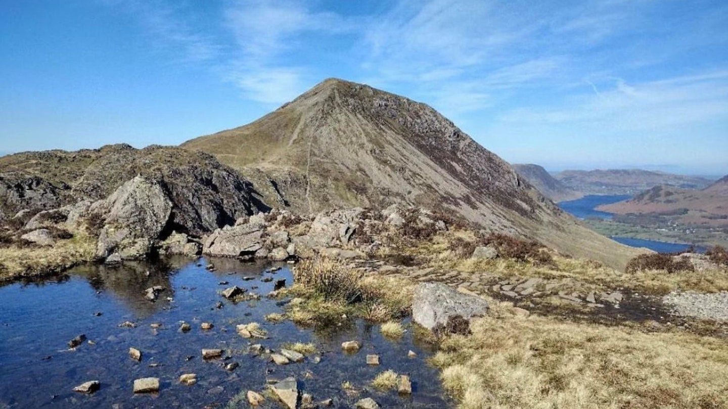
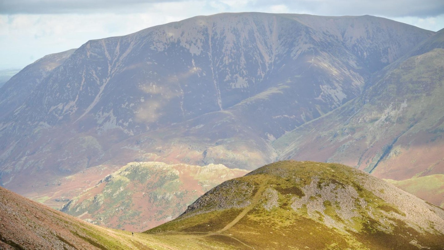
The ridge eventually melds into breathtaking views from High Stile looking towards Red Pike. Take care as you descend, as the rocks are quite loose and slippery in the wet. It’s another short leg to the final summit of your day. Follow the footpath along the saddle to Red Pike with a gentle push up to its summit.
-
On a clear day, you can see Buttermere below. Descend from Red Pike’s summit heading south-westerly following the obvious footpath which gradually gets steeper. There are larger boulder stones on the way down into the valley.
-
As you reach Ennerdale Forest, pass the fence and down to the main track. The is a very flat section ahead through the forest. It’s stunning.
-
After a good 5km walk through the forest, you’ll reach open space with a YHA building called Black Sail Hut. The footpath continues beyond the building with a gentle incline up to a footpath junction. As you reach the stream, the path bends sharp left, and a steep ascent is ahead of you. Take plenty of breathing stops on the way up here. And be sure to look back at the views. The path is obvious. As the footpath turns right, the land slopes gently until you reach the fence and path junction.
-
Continue ahead and take the path that follows the hillside. Continue along this path until it starts to descend gradually. You’ll recognise the screes of Honister Slate Quarry ahead.
-
At a crossing of paths, turn right to descend an old tramway. This is loose in places and gets slightly steep before it rejoins your outward path and flattens out to a nice finish. It’s worth a coffee stop in the Honister Slate café. There is also a lovely shop to look around.
What walking gear do I need for this route?
Here's a selection of the best walking gear selected by LFTO's testing team: Walking boots | Hiking daypack | Waterproof jacket | Walking trousers | Walking poles | Walking mid-layers | Base layers
Where can I eat and drink?
Buttermere is the closest village and offers a tearoom and café, plus the Bridge Hotel pub.
Where's the best place to stay?
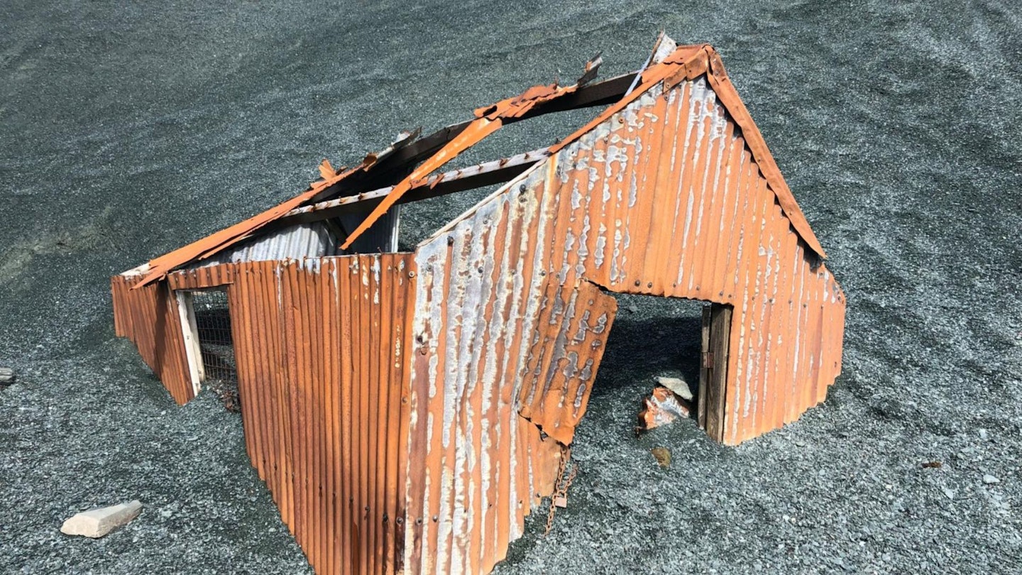
Not this old tin shed! Instead, Skye Farm campsite is a great location, or for more comfort there is the Bridge Hotel for both accommodation and food. YHA Buttermere is also a good shout.
About the author
Anna Humphries runs The Mountain Girl. With a lifelong passion for the outdoors and a dedication to empowering others, she has embarked on numerous challenging treks and assumed leadership roles. She writes regularly for Trail magazine.
This route originally appeared in the April 2024 issue of Trail magazine. CLICK HERE to become a Trail magazine subscriber and get 50% off a whole year of digital OS Maps