Britain's highest mountain is a complex beast of a peak – rounded and inviting from some angles, sheer and terrifying from many others. So what exactly is the best route up Ben Nevis?
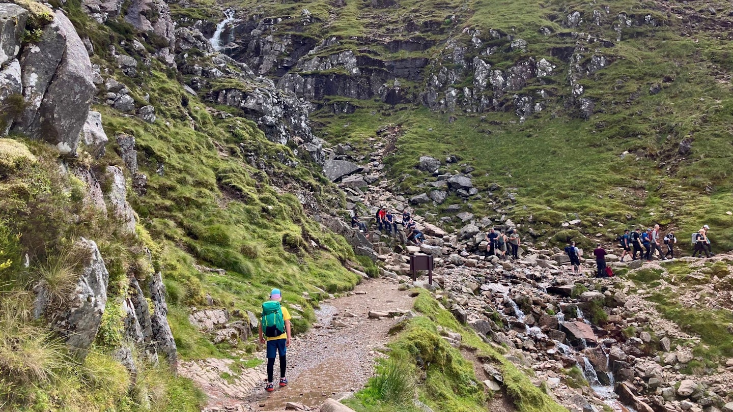
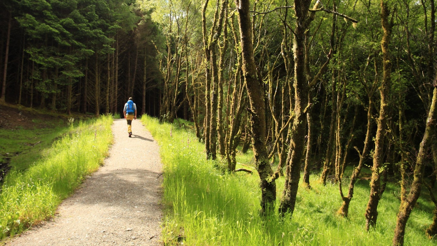
Most people climb it via the popular Mountain Track from the Visitor Centre in Glen Nevis. This route is best described as a long and busy walking route following a mixture of stone paths, chunky steps and scree trails for many hours, all the way to the 1345m summit.
Despite some navigational obstacles on the summit plateau, this is unquestionably the most straightforward to climb Ben Nevis, but in our opinion it's far from the best.
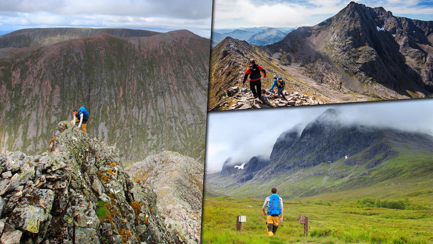
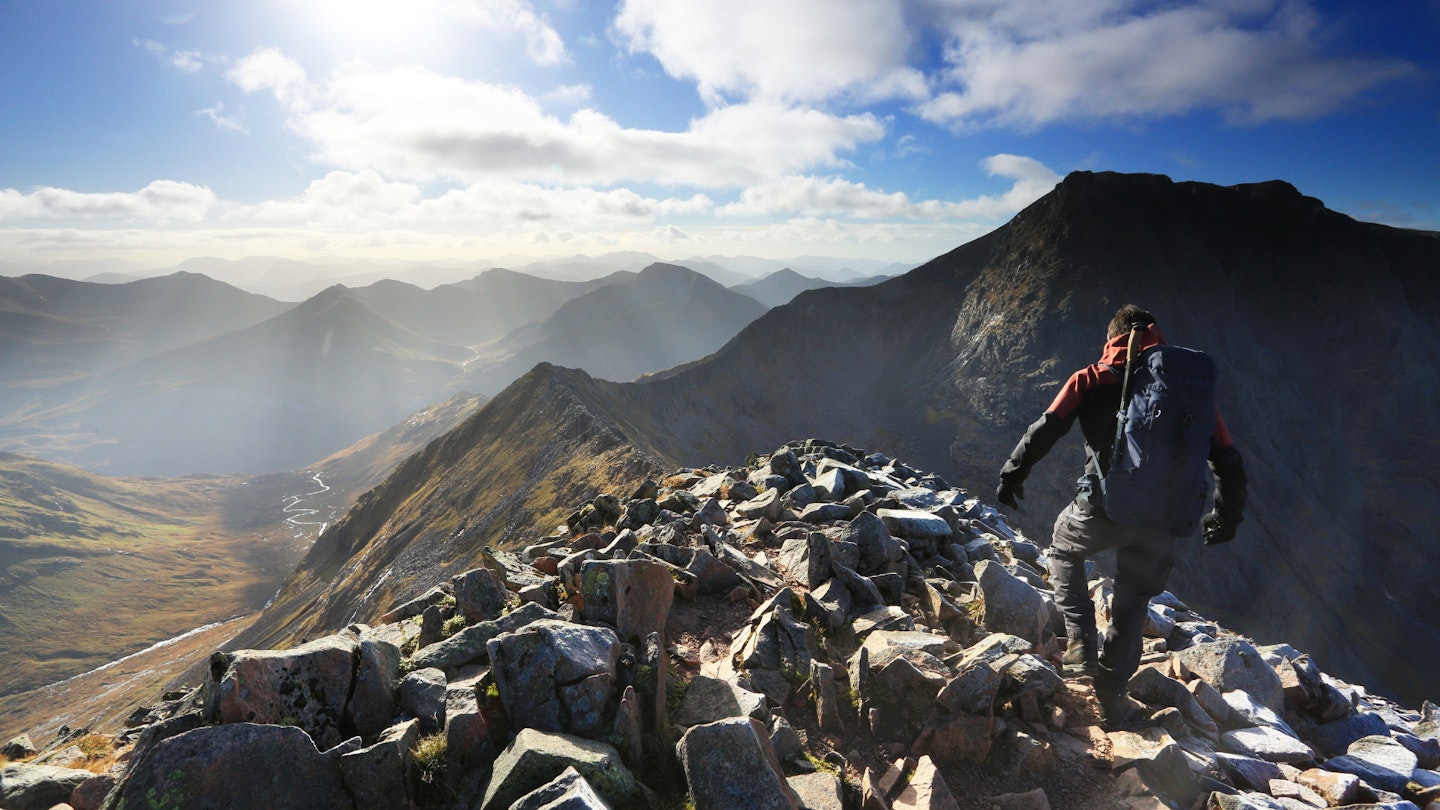
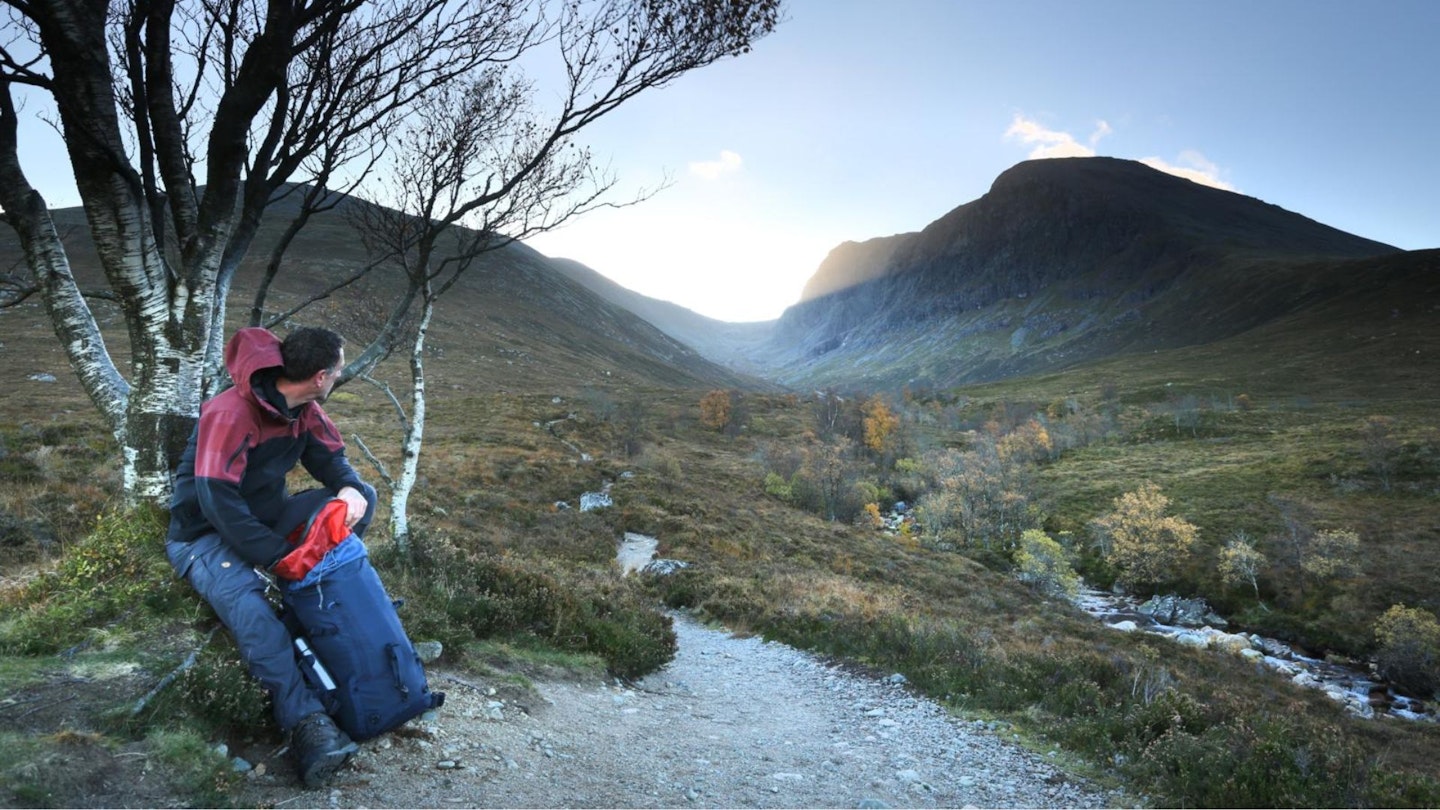
If you approach the mountain from the north, everything changes. From the dramatic rocky sweep of the CMD Arete (above) to the adrenaline-pumping Ledge Route that spiders its way straight up those mighty northern cliffs, there is challenge aplenty on Ben Nevis.
Which route you pick very much depends on your levels of ambition, experience and ability. The Mountain Track is a hike, the CMD Arete is an exciting and exposed ridge traverse, and the Ledge Route is a Grade 2 scramble that shouldn't even be considered unless you know exactly what that grading system means.
Below we take a look at all three routes in a little more detail. Take a look through the images and descriptions, choose the route you think best suits yourself as a hiker, then download our route guide and start planning your trip to the roof of Britain.
Route 1: The Mountain Track
Best for: Hillwalkers of all ages

Distance: 14.8km (9.2 miles) | Total ascent: 1332m | Time: 7-8 hours
Download our digital route guide to the Mountain Track, HERE
The Mountain Track (also known as the Tourist Track or Pony Track) is the route any who's done the 3 Peaks Challenge will be familiar with. Starting and finishing at the visitor centre in Glen Nevis, this popular walking route circles around the smaller peak of Meall an t-Suidhe on a well-constructed path before reaching the 'Halfway Lochan' ( Lochan Meall an t-Suidhe).

The early stages of the walk are fairly straightforward and get you warmed up perfectly with ever-improving views providing entertainment as height is gained.
Above the lochan you turn sharply right, and the route soon crosses the Red Burn. This is a deep-cut gully in the side of the mountain with water spilling down it. In winter conditions, it can freeze over and get banked out by snow.
Above the Red Burn, the track settles into a series of zigzags, which in the lower sections are mostly easy to follow but can drift over with snow in the higher sections unless you visit in high summer. This is a punishing and seemingly never-ending part of the walk.
As the zigzags start to relent they skirt perilously close to the edge of Five Finger Gully. In ascent this isn’t much of an issue so long as you give it a wide berth, but in descent the natural line tends to force you towards it.
Guard against this as the slopes are convex and steepen rapidly into crags. The gradient eases above Five Finger Gully until you hit a brief rise known as McLean’s Steep.
If it is clear when you hit the summit plateau, you’ll become aware of the cornices (snow overhangs) that ring the North Face to your left (north).
It's worth looking over the face as there are impressive views of Tower Ridge and the Orion Face. However, you need to keep back from the edges by a good margin as the cornices often extend 30-40ft over the cliff edge, and if they collapse they take a good portion of snow with them from the plateau.
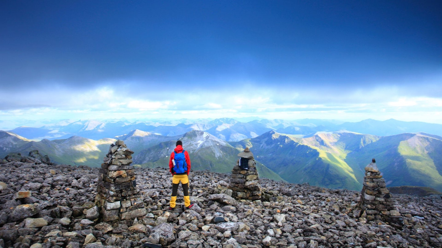
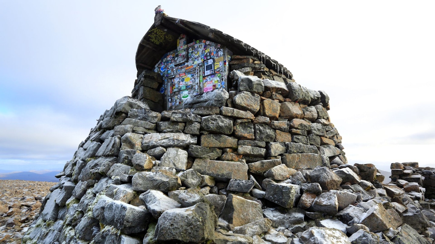
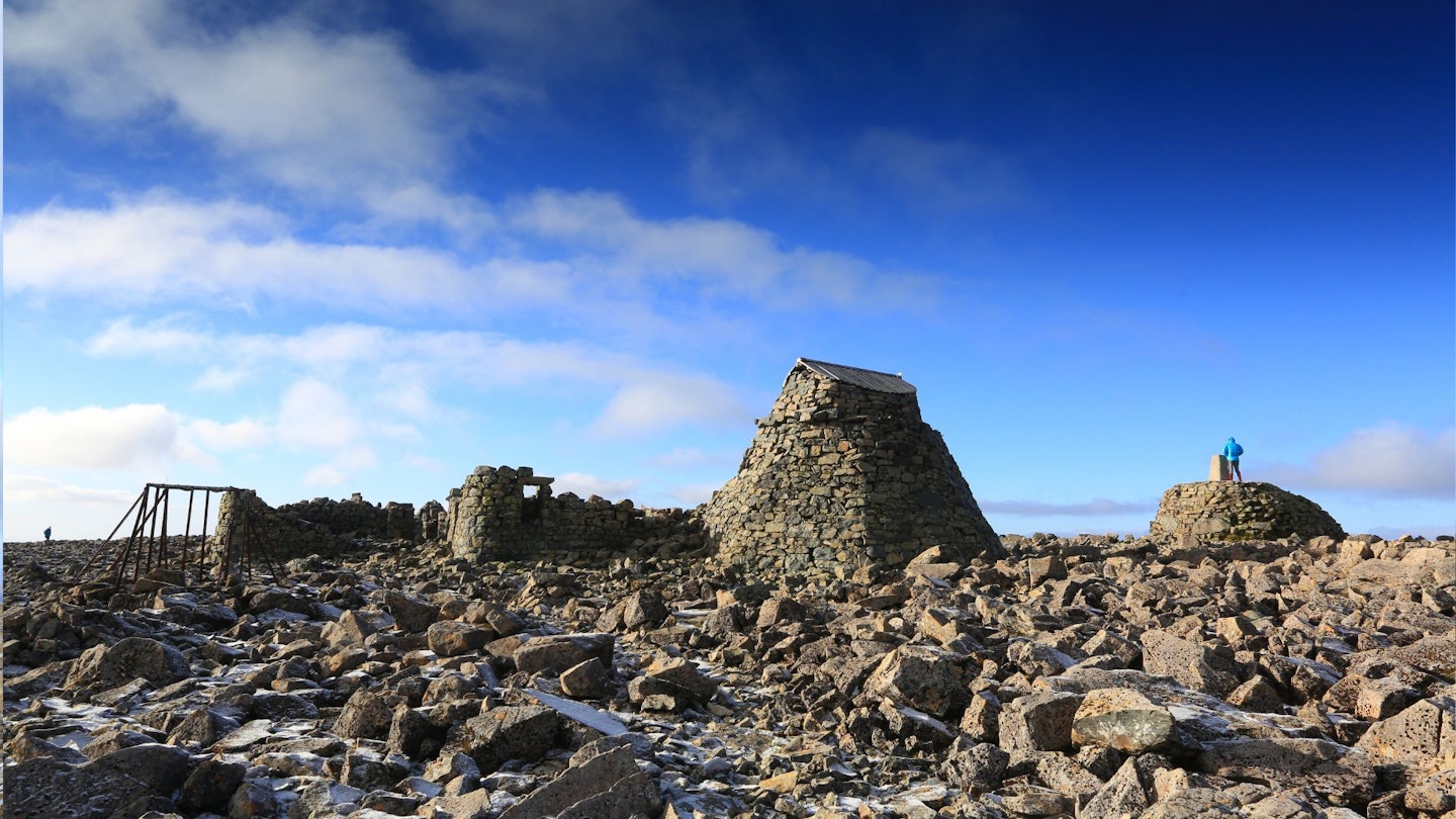
The summit is marked with the observatory ruins, a shelter (above), cairns and a trig point but most of these get buried after a heavy winter. Often only the tip of the trig point and the shelter remain.
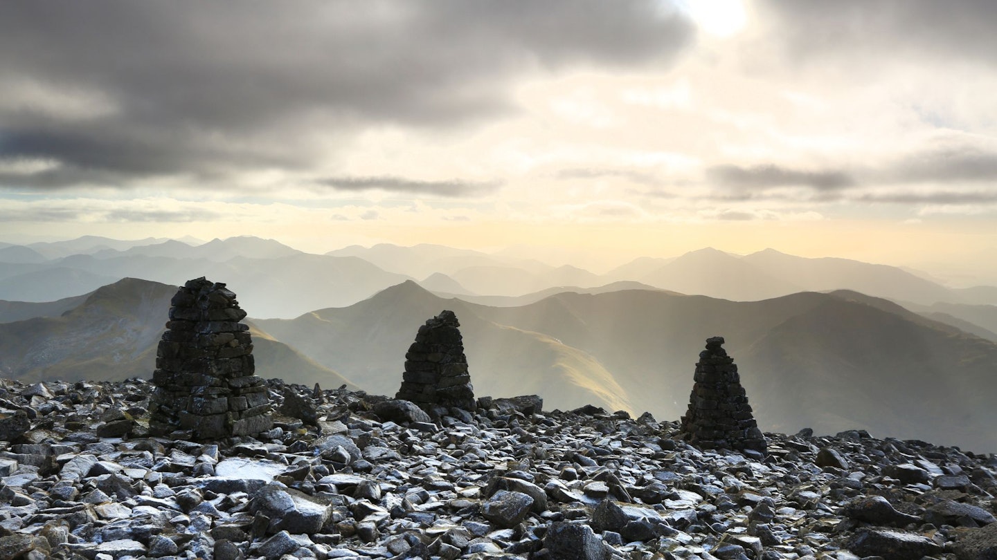
Leaving the summit plateau in winter or in poor visibility is particularly hazardous. A series of navigation cairns starting close to the summit trig point have been constructed to help avoid the worst hazards. However, even at 1.8m high some have been buried so it is imperative that you are prepared and able to navigate without the assistance of the cairns.
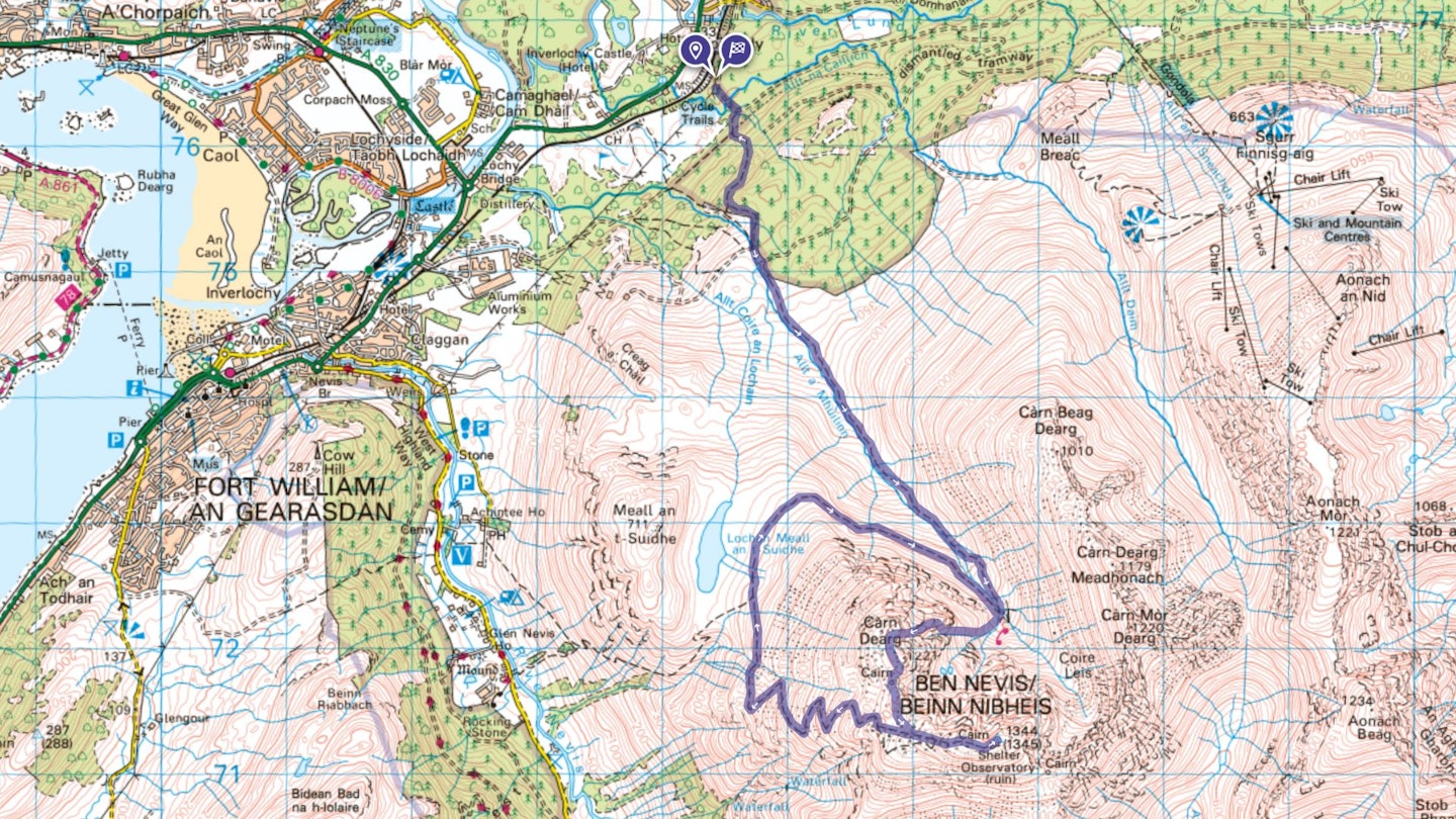
Route 2: The CMD Arete
Best for: Adventurous hikers
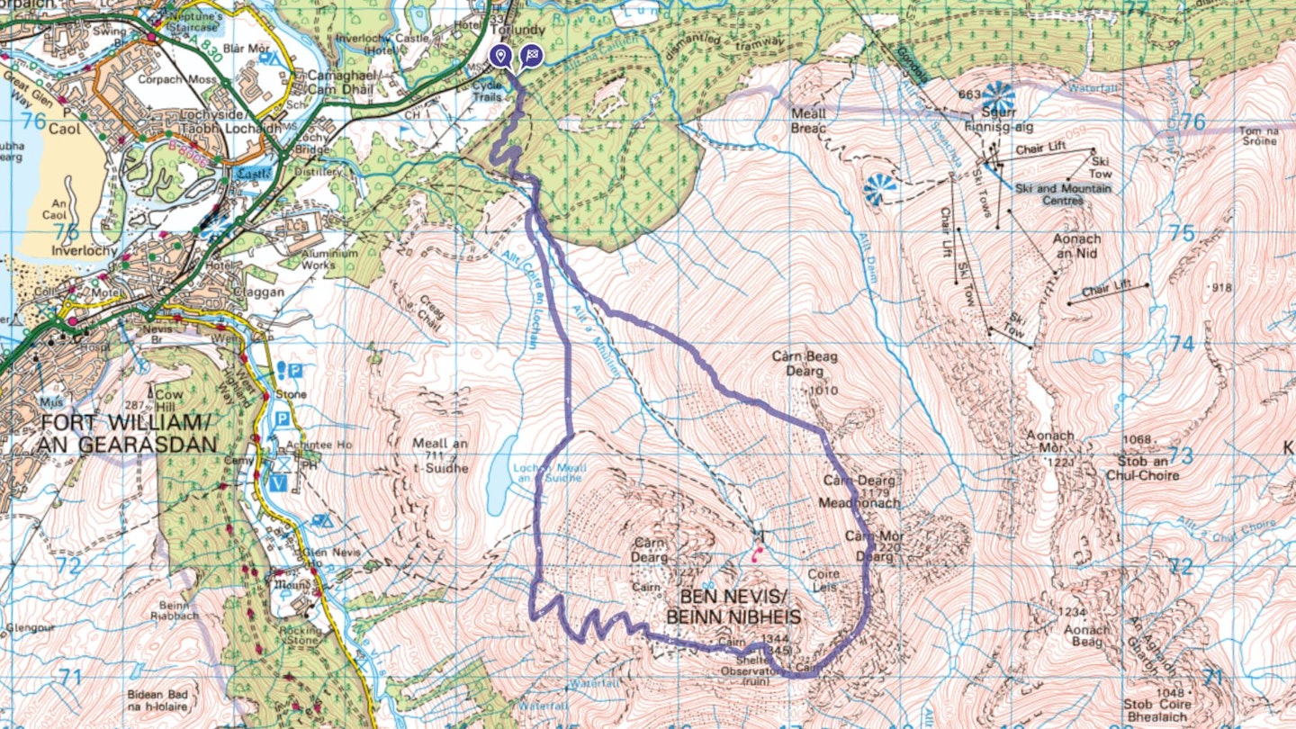
Distance: 17km (10.5 miles) | Total ascent: 1610m | Time: 8 hours
Download our digital route guide to the CMD Arete, HERE
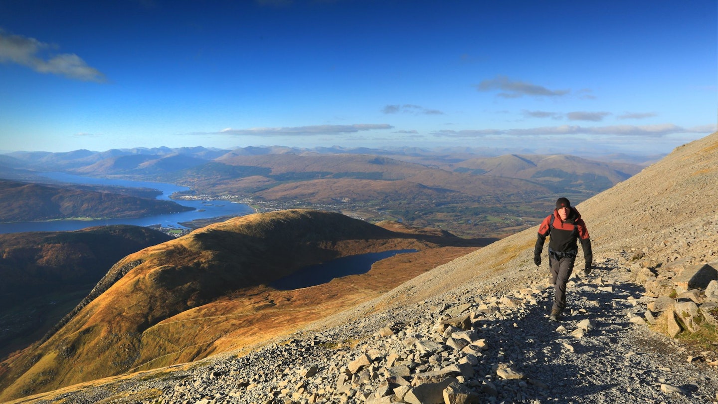
The Carn Mor Dearg (CMD) Arete is without doubt the most spectacular walker’s route to the top of Scotland's highest mountain. This spicy ridge walk unforgettably presents the vision of Ben Nevis as a jagged rocky giant.
You start from the North Face car park, where a track and then path lead up through the trees to connect with the Allt a’ Mhuilinn path. This new(ish) pitched path makes light work of the first leg and the boggy sections that used to plague this route.
The ascent to Carn Beag Dearg is the main climb of the day. It can be started at numerous places from the Allt a’ Mhuilinn path. However, the higher up you start the steeper it is. The gentlest line is up the broad crest that starts about 1km past the dam/water intake.
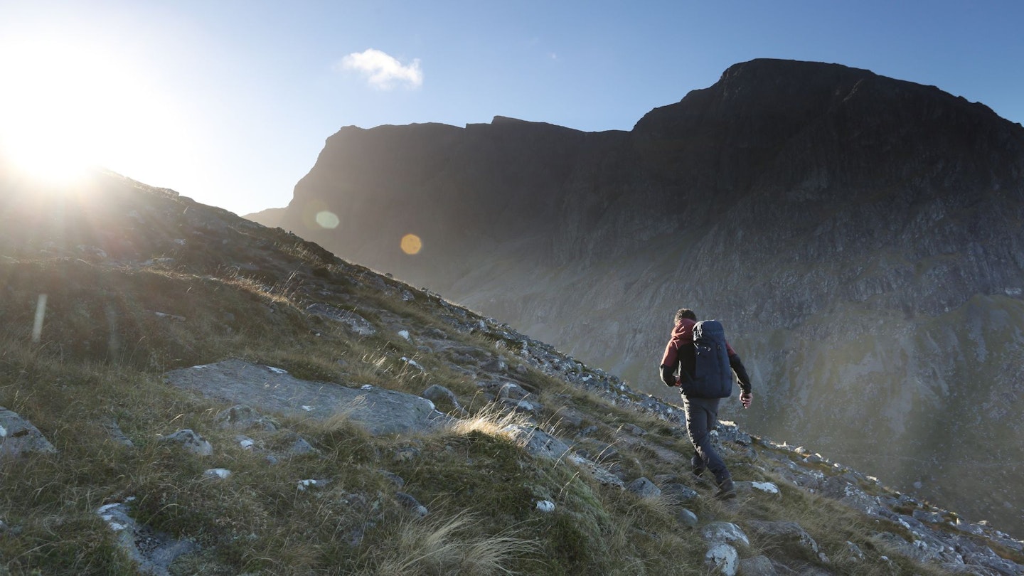
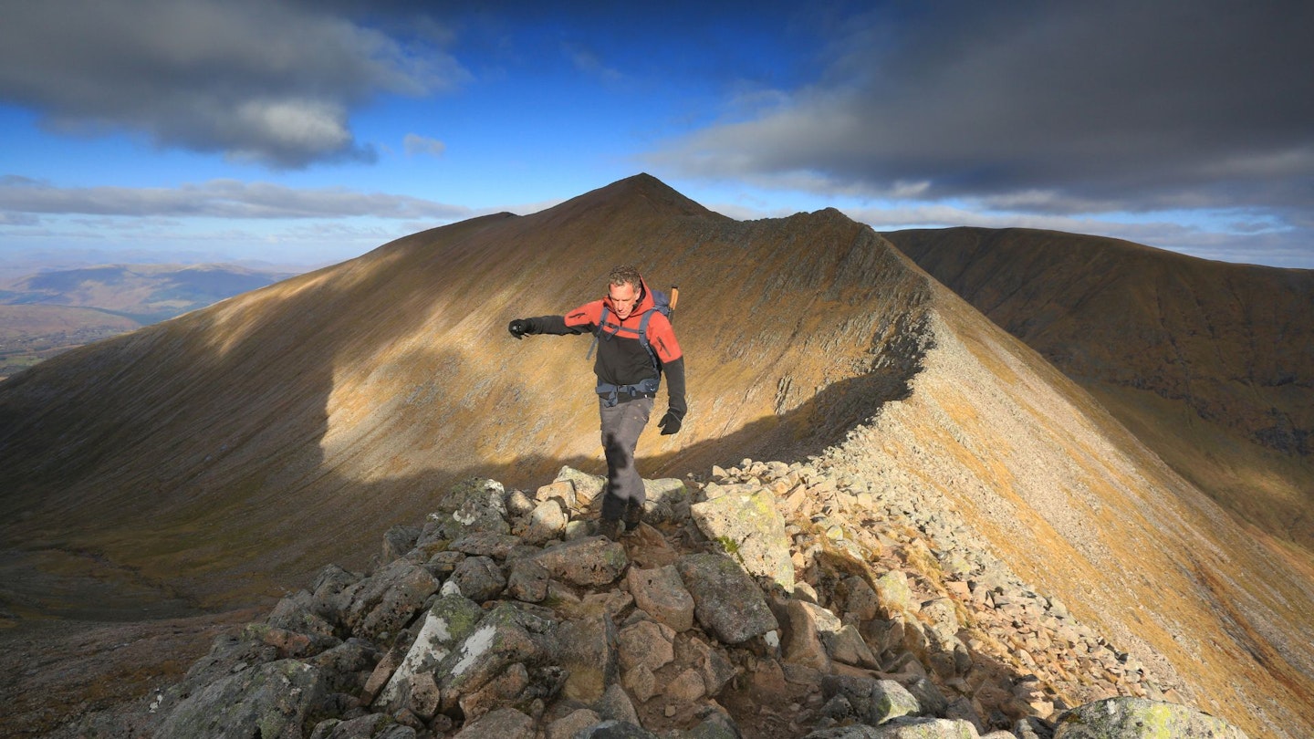
The climb doesn’t relent until you hit the summit of Carn Beag Dearg, so it’s worth zigzagging and setting a steady pace. Once on top, a great selection of vistas opens out and the walking along the crest is fantastic.
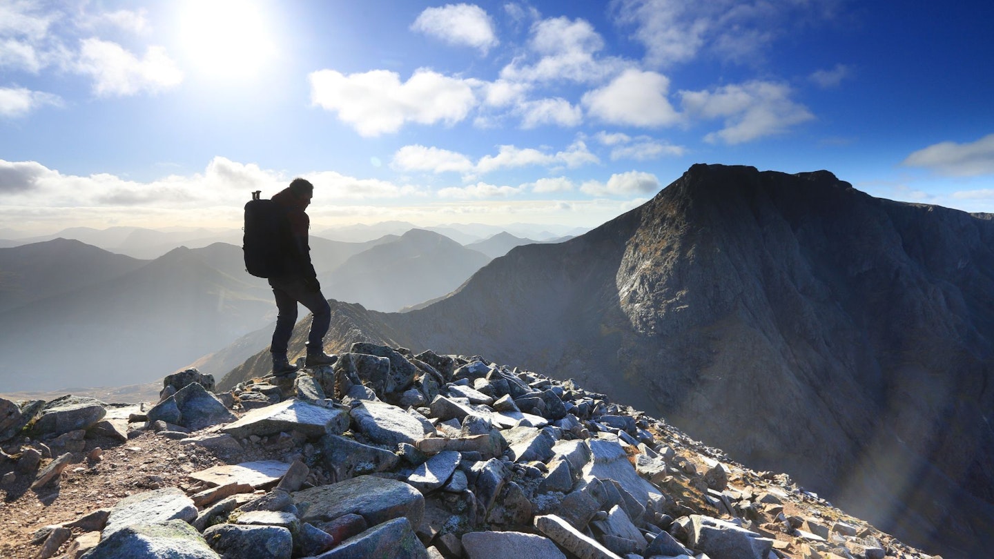
Carn Mor Dearg (below) is one of the eight 4,000ft peaks in Scotland and it’s a fine summit in its own right. There is a small ring shelter on top and it’s worth taking a break here to rest for the next section.
It’s also about the best place to take in the north face of Ben Nevis. If you look carefully, you should be able to spot all the famous features like Tower Ridge, the side of the Orion Face, Carn Dearg Buttress and at the far right-hand end Castle Ridge.
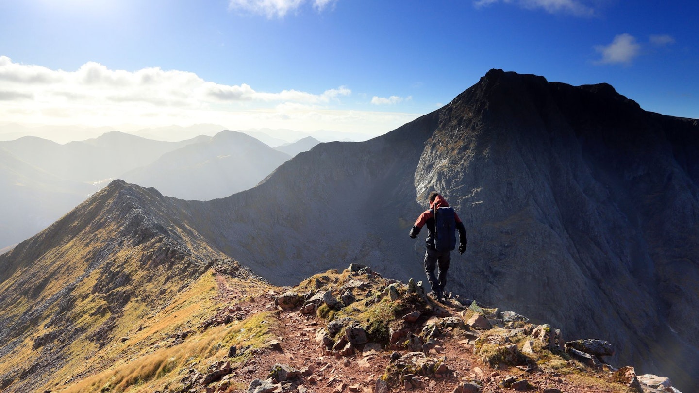
Looking down onto the Carn Mor Dearg Arête, it's easy to be put off. But once you get going and make the descent onto the ridge, it soon relents. There are exposed sections with steep crags below, but you will find plenty of big and comforting holds and pinnacles.
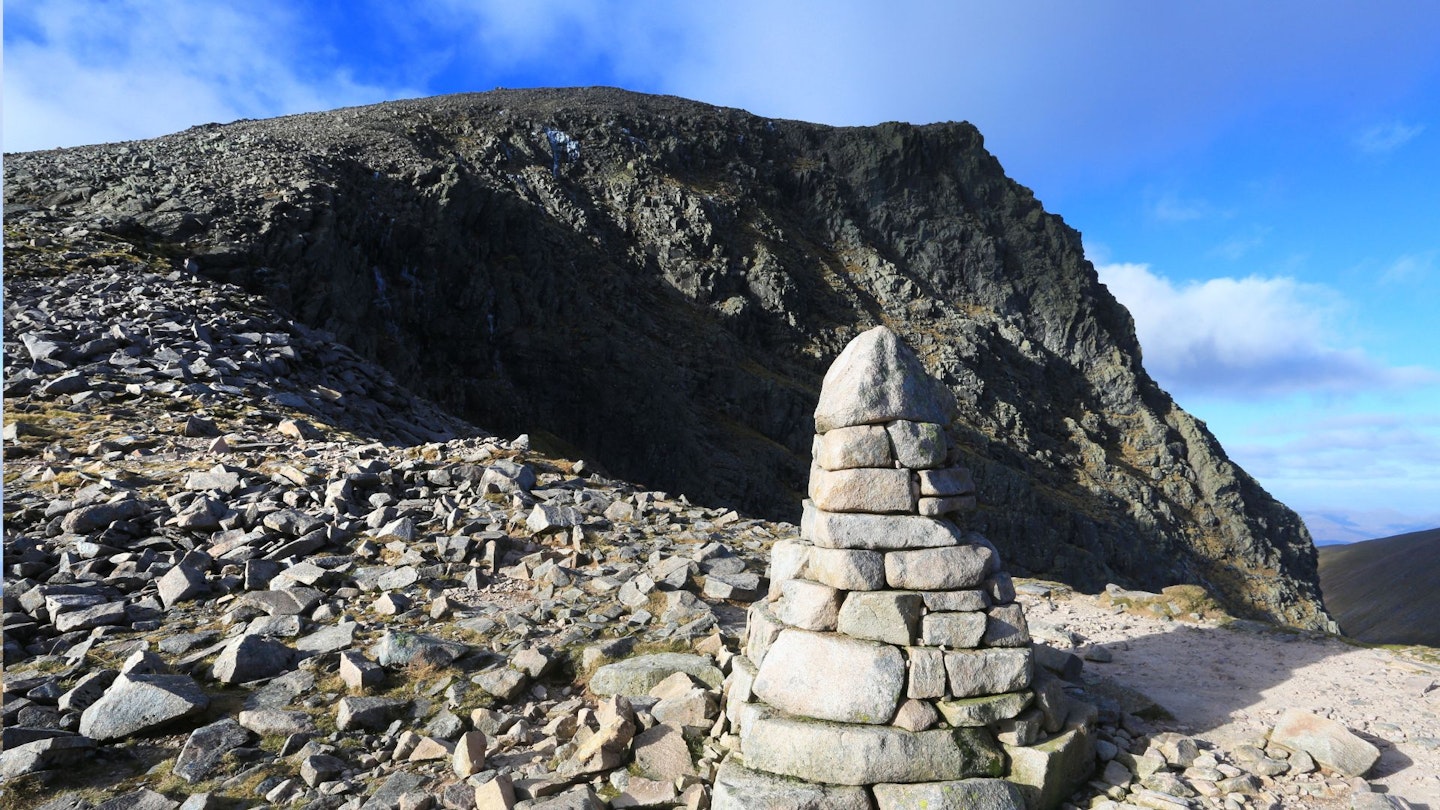
All too soon the arête is over and you arrive at a narrow col at the head of Coire Leis. This used to be the site of a series of posts put in place to afford a winter abseil route for climbers wanting to regain the bottom of the crags after completing climbs on the north face. The posts and aluminium sign have now been removed, replaced by a permanent marker cairn.
It also marks the start of the final ascent to the summit of Ben Nevis. Under snow and ice cover this eastern shoulder can be quite difficult and has caught many parties out. The slope is convex, and a slip would need to be arrested quickly as the run-out is over the steep crags of the Little Brenva Face.
Snow and ice cover can extend into early summer, so check locally as to its state. And take an ice axe and crampons if necessary.
The summit plateau also holds considerable quantities of snow into summer. The surrounding crag and gully edges are often hidden by unstable cornices. Leaving the summit plateau in winter or in poor visibility is particularly hazardous.
From the summit, follow the Mountain Track down to the Halfway Lochan, then from the path above Lochan Meall an t-Suidhe head north then drop down to the Allt a’ Mhuilinn. The slopes are steep and heathery but fortunately short-lived. Generally, the Allt a’ Mhuilinn is easy to ford but if it is high you may need to head upstream to find a safe crossing.
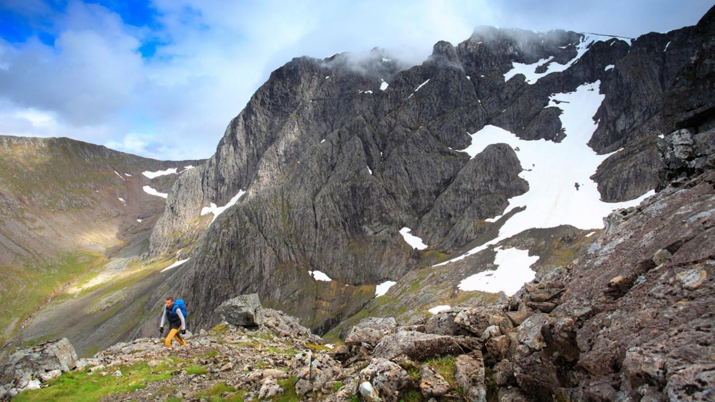
Route 3: The Ledge Route
Best for: Confident and experienced scramblers
Distance: 17km (10.5 miles) | Total ascent: 1420m | Time: 8 hours
Download our digital route guide to the Ledge Route, HERE
The Ledge Route is the hardest route you can take up Ben Nevis without ropes and harnesses. And on some parts of the route, they might not be a bad idea if you aren't supremely confident on steep, exposed and challenging terrain.
Like the CMD Arete, this route starts from the North Face car park and winds up through the woods before joining the Allt a'Mhuilinn path.
The path meanders gently alongside the burn with the huge bulk of Carn Dearg dominating the approach to the CIC hut. About a kilometre short of the hut, the path upgrade ceases and you continue on a rougher old track to the hut.
Just north of the CIC hut, cross the burn and scramble up into the bottom of No. 5 Gully. With the crags and turrets of the North Face above you, you'll start to get a real feel for the nature of this route. If you feel intimidated here, the rest of the route probably isn't for you!
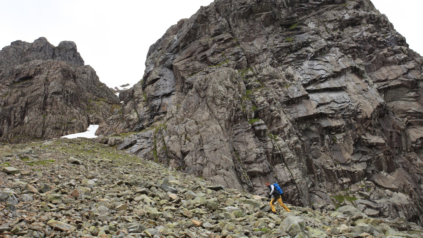
Climb up the gully until you reach an obvious ramp on the right leading up to a slanting shelf below a fringe of overhanging cliffs. Follow the slanting shelf to leave the gully and traverse below the band of crags – and take great care. It can be wet, greasy or even icy, and a slip here could have consequences.
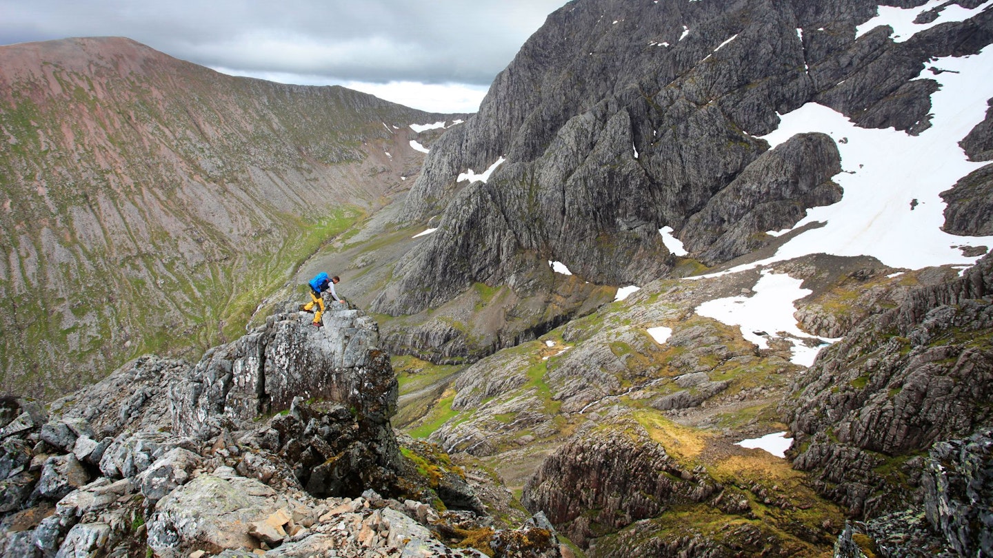
Ascend a rocky trench to your left, eventually making for the shattered crest of a rocky ridge where some huge, perched boulders can be seen on the skyline.
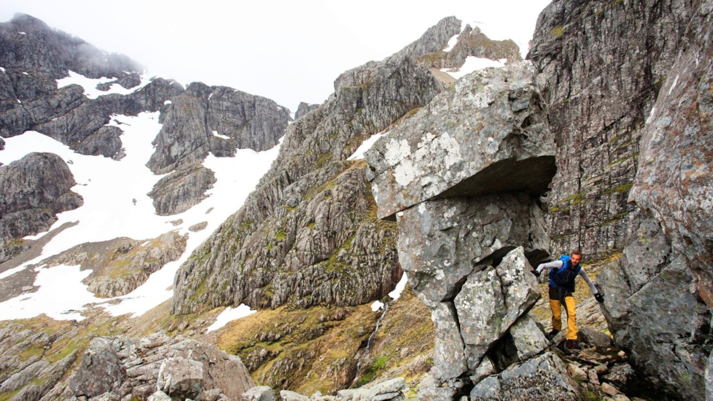
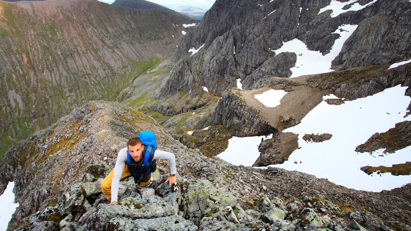
The route now starts to feel different and less enclosed, with scrambling along a narrow rocky crest of boulders. Ascend west along the ridge, over blocks and sections of arete. Also take time to drink in your surroundings, because the views up to The Ben's summit are something else.
You then reach a narrow section of ridge above the cliffs you traversed beneath earlier. This involves a short, exposed downclimb with many crampon scratches and some quite polished rock. There’s an alternative to this ‘bad step’ on the north side a few metres back down the ridge. It’s less exposed and with better holds, so we'd recommend it if you don't fancy the scramble pictured below.
The ridge now broadens and easy scrambling leads onto the plateau of Carn Dearg. Either side of the ridge are corries often fringed by huge overhanging ledges of snow, so keep back from the edge.
Having reached the plateau you can properly bag the top of Ben Nevis. Go along the rim of the corrie then head south to join the Mountain Track (and tourist crowds) to the 1345m summit cairn.
To return to the car park you can take the Mountain Track to the ‘Halfway Lochan’ then make the rough traverse across the moors towards the Allt a’Mhuilinn, find a safe place to cross, then follow the signs back to the North Face car park.