
Autumn is the perfect time to visit the area near Longshaw, Padley Gorge, Higger Tor and the Burbage Valley – which link together to form a classic Peak District walk.
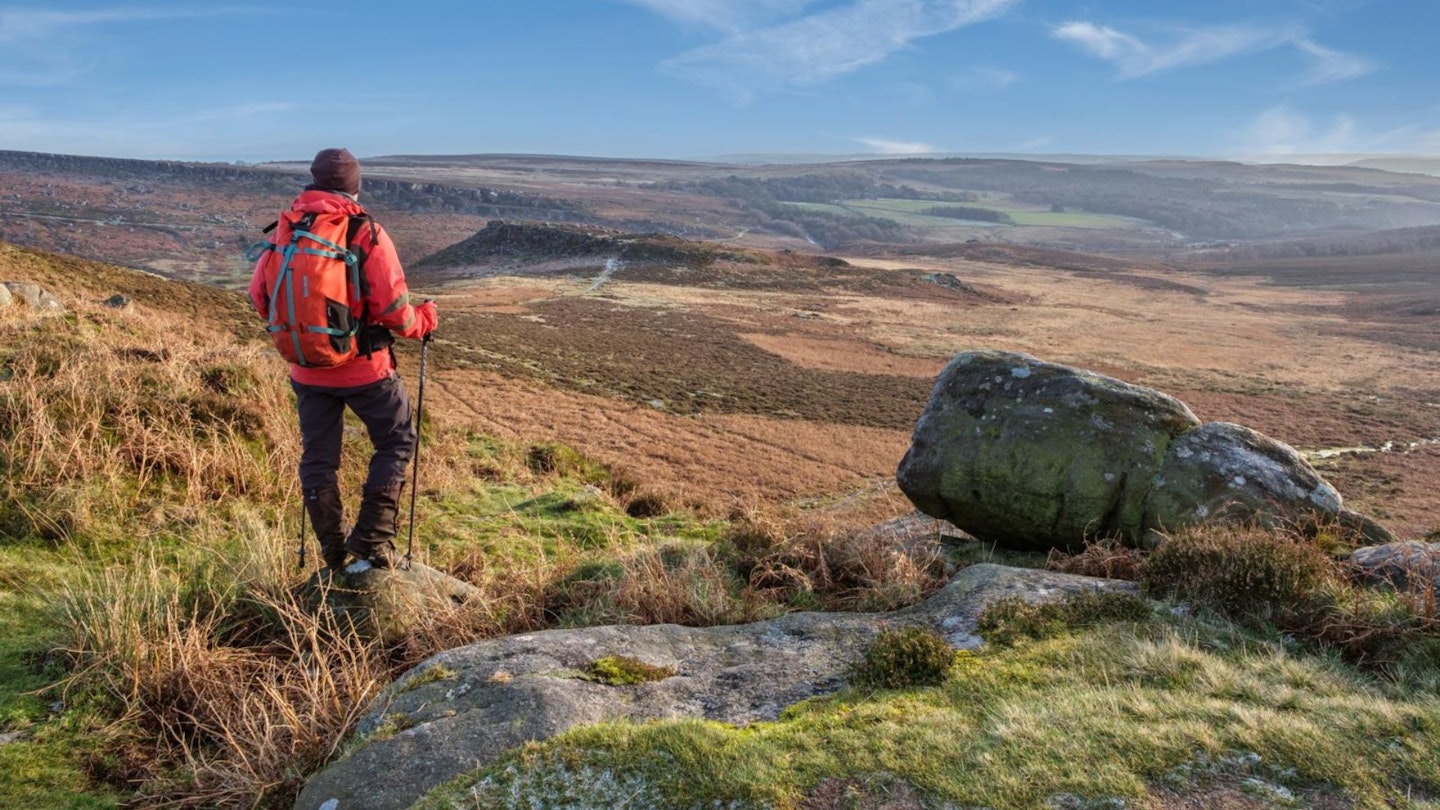
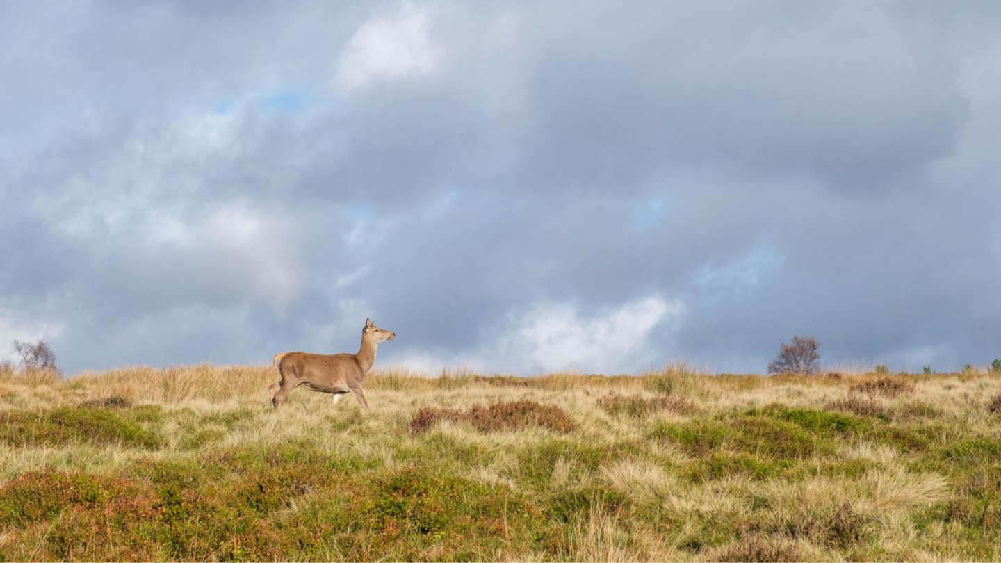
You may be lucky enough to see (or hear) stags roaring their territorial claims during the autumnal rutting season as you descend moorland near White Edge Lodge. Then, a little-known craggy viewpoint overlooks the Derwent valley before more woodland descends to Padley Gorge.
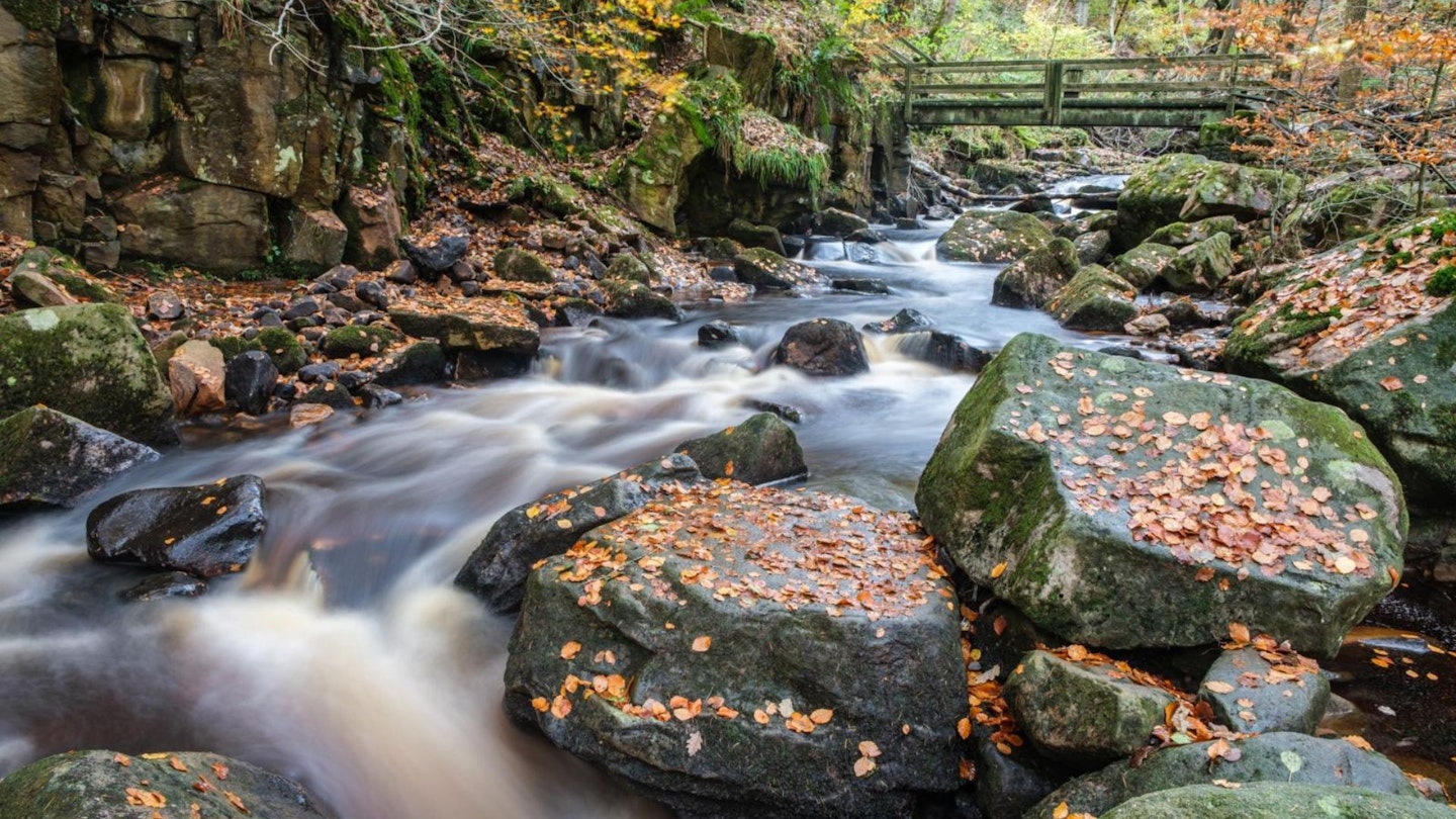
This contains one of the Peak District’s rare woodland streams surrounded by beautiful beech trees (and other deciduous species), and is particularly beautiful in autumn as the leaves turn golden auburn-brown.
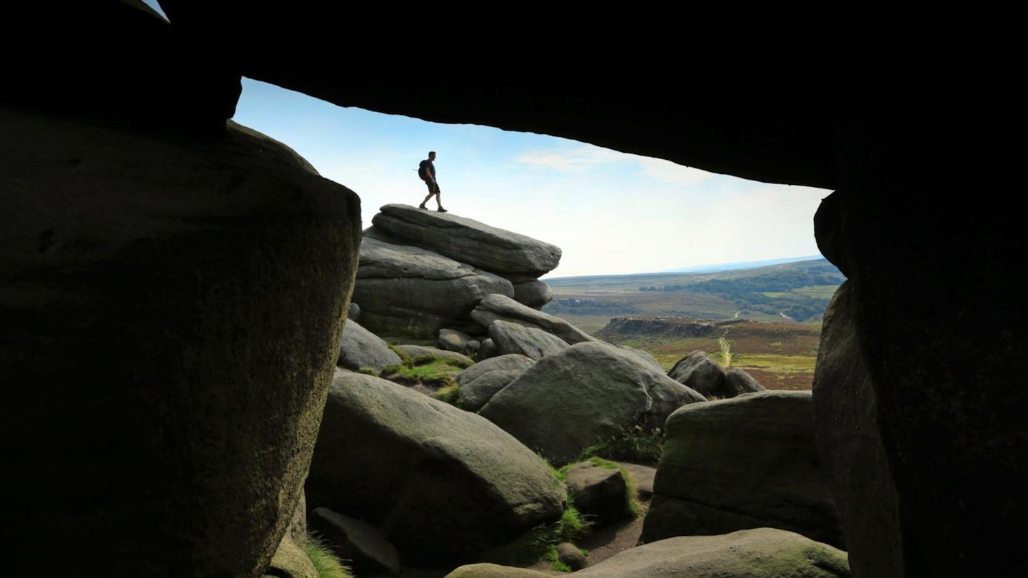
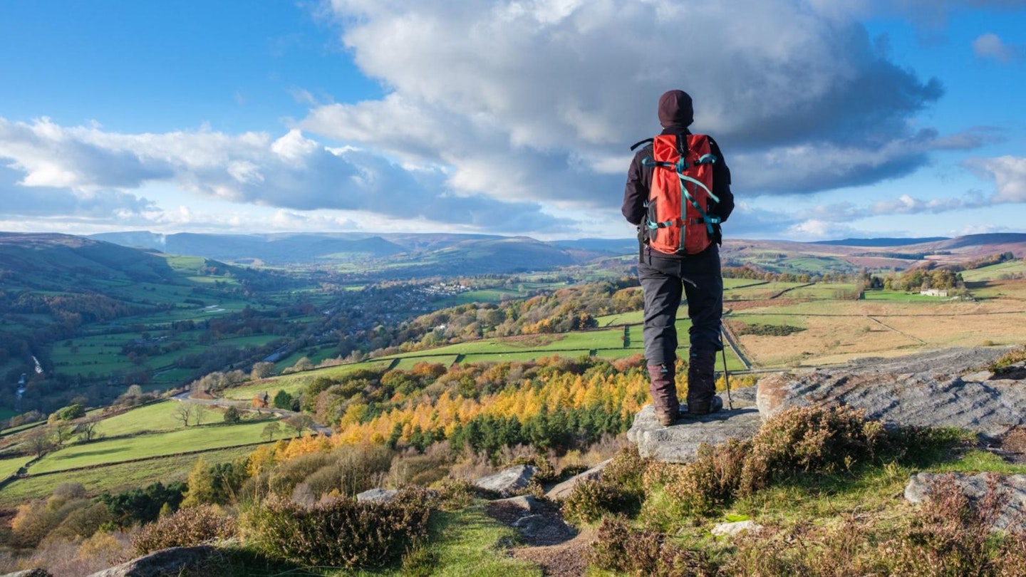
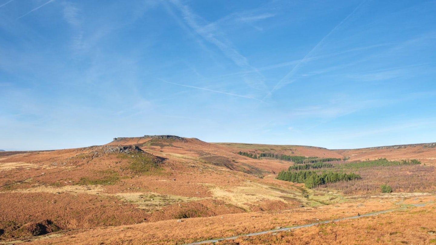
Rising above Millstone Edge, ver heathery bracken moorland, you will pass the bouldery gritstone outcrop of Over Owler Tor, with a fabulous view out to the Great Ridge, Hope Valley and towards Stanage Edge.
Pass above the historic Bronze Age encampment at Carl Wark. Was it a fortified camp? (Certainly it has ancient defensive surrounds, but… where do they get their water supply if defending a siege?) Or perhaps a more social or ceremonial gathering place? Enjoy yet more stunning views from Higger Tor, then take some less-trodden peaty moorland paths to well-earned refreshments at the pub or café.
How hard is walking around Higger Tor?
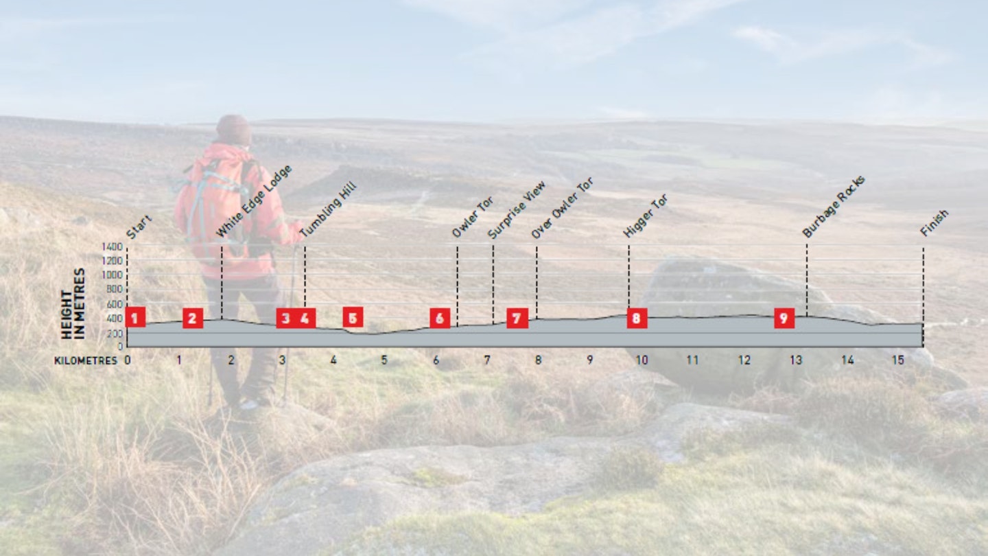
DIFFICULTY: Easy | DISTANCE: 15.5km | TIME: 5 hours | TOTAL ASCENT: 480m
FITNESS: Relatively easy for experienced hillwalkers; a few short steeper slopes. Newbie? Allow lots of time and go prepared.
TERRAIN: Boggy moorland, from good paths to faint/pathless, rocky/muddy/narrow/woodland ones. Some streams and main roads to cross. Steep descent to Padley.
NAVIGATION: Surprisingly fiddly navigation, especially in woodland. Moorland challenging in low visibility.
Where is the start of the walk?
Longshaw parking is pricey for non National Trust members. Surprise View is cheaper but provides woodland rather than refreshments at the end of the walk!
What's the best map for walking Padley Gorge and Higger Tor?
-
CLICK HERE to view and download our digital route guide in OS Maps
-
OS Explorer OL1 and OL24 (1:25k)
-
OS Landranger 110 and 119 (1:50k)
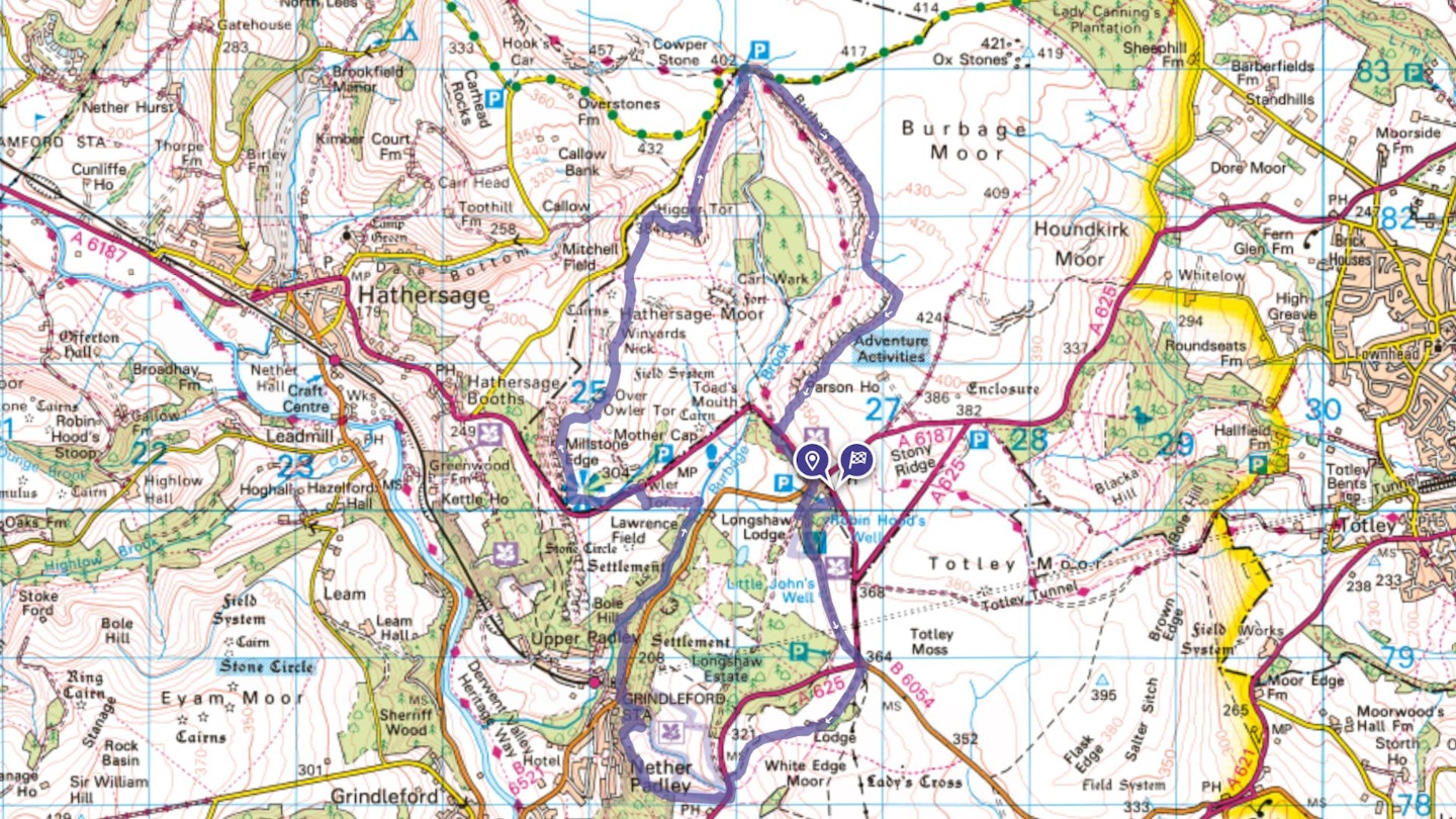
Padley Gorge and Higger Tor | Step-by-step route guide
-
From Longshaw’s Woodcroft car park, descend towards the café, then left up an estate track to a white gate. Turn right onto a wide track. Pass just below the Wooden Pole (formerly a navigation marker, on the boundary between Totley and Hathersage parishes), and across a side road at a road junction.
-
Take a track past White Edge Lodge and down to a road. Watch out for deer, particularly when descending below the lodge. Cross road, go south along the wide verge towards a right bend. Take a path right, crossing a wall line into NT Jubilee. Keep a wall on your left.
-
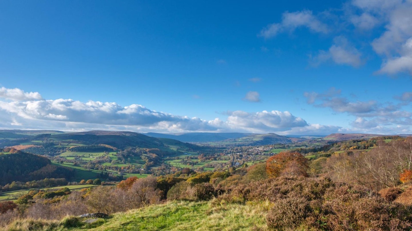
As the wall turns a corner, fork slight right, then roughly west-north-west through silver birch woodland. Continue more north-west along a narrow grassy spur. At a craggy edge there’s a great view across the Derwent Valley, Eyam Moor and Win Hill.
-
Drop right from the crags and down to a wall. Stay left of this at a corner, passing along the top of silver birch woodland, then fork right just after a constructed gap in the wall. After about 150m, ignore a wall gate on your right; instead, turn left and downhill. About 150m further on, fork very sharp right onto an easily missed narrow path. Cross, then descend by a stream on a wider rocky path, then cross a road.
-
Enter Padley Gorge by the 50mph sign. It's worth a wander around the lovely beech woods, especially in their autumn glory. The main path roughly parallels the road then, at a tree stump shaped a bit like a chair with a tall ragged back, turn left and straight downhill to the stream, descending steps in a short bluff then across a footbridge. Stride steeply up the far valley side; then more gently upstream to the edge of woodland and the second of two further footbridges.
-
Take the main ‘holloway’ path leading just above Owler Tor. Cross a road, pass through the car park then take a constructed path west to Surprise View. Follow the fenceline north above Millstone Edge; there are some great views across the Hope Valley, out to Bamford and Shatton Edge.
-
Directly opposite Over Owler Tor, fork right on an initially wide path leading up through low outcrops to the Tor, with views over Carl Wark and Higger Tor. Head briefly east along a slight bluff from the Tor then descend. Continue near the edge of the plateau, passing Winyards Nick, then left of a walled enclosure. Now ascend the western end of Higger Tor, curving slightly behind the visible edge, then up the short rear edge to the top (the Ethel). Head east above the craggy edge then north, enjoying the views over the Burbage Valley.
-
Just beyond three low wooden marker posts in a row, fork right on a clear path. At Upper Burbage Bridge, cross below both bridges then take the upper of two paths. This stays above the craggy edge, then descends gently to a path junction near two side-streams.
-
Cross both streams then curve gently south-east above the now much more vague edge. Cross another path by a couple of cairns, then bear right above steeper crags. Join a couple of lower paths below a part-hewn stone trough, then descend the fading edge to the road near Burbage Bridge. Cross the road into NT Longshaw woodland; bear left to stay on the bridleway. Cross another road onto Longshaw’s estate access and, after about 300m, turn left up a track by the café, then left again back to Woodcroft Car Park.
What walking gear do I need for this route?
Here's a selection of the best walking gear selected by LFTO's testing team: Walking boots | Hiking daypack | Waterproof jacket | Walking trousers | Walking poles | Walking mid-layers | Base layers
Where can I eat and drink?
The Fox House pub and Longshaw’s Café are both good choices with a wide variety of hot and cold drinks/food.
Where's the best place to stay?
The Hathersage/Grindleford/Hope Valley area offers lots of choice, including campsites and a YHA (NB Castleton, not Hathersage). The Fox House is a good option.
About the author
Chiz Dakin is an award-winning writer, photographer, filmmaker, and avid traveler. She's written countless guides and articles for Trail magazine and LFTO about walking and hiking all over the UK and is one of the most trusted route hiking experts out there.
This route originally appeared in the November 2024 issue of Trail magazine. CLICK HERE to become a Trail magazine subscriber and get 50% off a whole year of digital OS Maps