The jagged landscape of the Isle of Skye draws thousands of visitors to Scotland year after year – and its highest mountain Sgurr Alasdair is one of the island's most prized scalps.
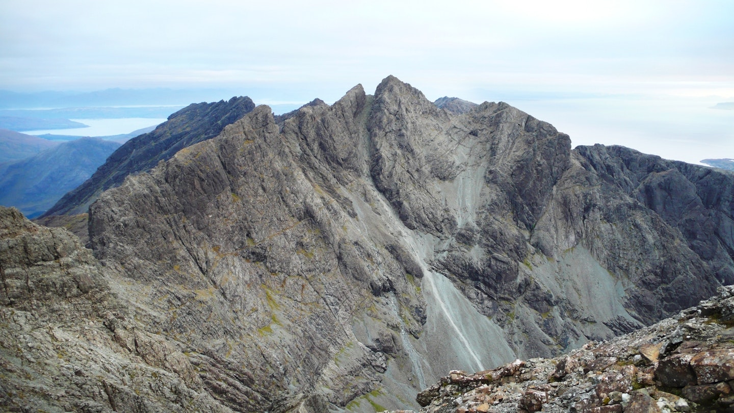
The Cuillin Ridge is the crown jewel of Britain's most mountainous island, with climbers and hikers flocking to traverse the ridge and bag its Munros, while sightseers gaze on its beauty from below.
Sgurr Alasdair stands at an impressive 992m, and is also the UK’s tallest island mountain. This provides an interesting and exciting route for those wishing to sample what the Cuillin has to offer, while also offering a short and achievable option for those not quite ready to tackle the ridge in its entirety but still keen to feel its volcanic rocks beneath their boots.
And it isn't just boots you'll need on this route, because the vast scree slope of the Great Stone Chute may require hands to steady yourself in both ascent and descent, while the airy and exposed summit ridge is a real test of nerve and scrambling skill.
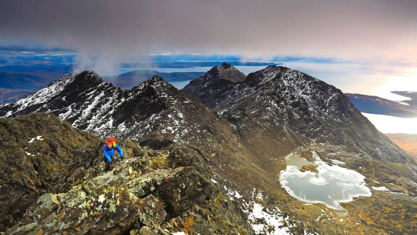
I have to say though, this is one of my all-time favourite British mountain days. Despite being a fairly routine out-and-back in terms of the route, Sgurr Alasdair feels like it has a little bit of everything. Coire Lagan is an impressive and lonely place, the Great Stone Chute is unlike any other mountain feature I've seen in Britain, the summit ridge is exciting and borderline scary, and the views from the mountain's tiny summit are something else.
Weather on Skye is hard to predict, but if you can somehow plan this ascent on a calm and dry day, you'll have the time of your life. Go braced for steep ascents and descents, wobbly legs on the summit ridge, and arguably the best views you'll find anywhere on our islands.
What a route!
How difficult is climbing Sgurr Alasdair?
DIFFICULTY: Hard | DISTANCE: 9km (5½ miles) | TIME: 5-6 hours | TOTAL ASCENT: 990m
FITNESS: Like most ascents on Skye, you'll be walking from sea-level to summit so it's a big pull up a big mountain, but in terms of fitness it should be comfortably possible for most regular hillwalkers and hikers.
TERRAIN: Loose gravel and dirt tracks, then steep terrain with exposed and very rocky tracks, with steep scrambling on the approach. Loose and exposed scree on ascent to the ridge, with large loose rocks further up. Narrow and exposed Grade 2 scrambling ridge to the summit with ledges providing another option to lessen exposure.
NAVIGATION: The route itself is fairly straightforward, going up and down the same way without too many twists and turns. However, as with most upper sections of the Cuillin Ridge, the rocky edges can all look very similar in low cloud (and often without being in cloud). Make sure you read the directions carefully and triple-check everything if you feel unsure. The exposure is high near the summit and a wrong move would be costly.

Is Sgurr Alsadair the hardest Munro on Skye?
Like many of Skye's Cuillin Munros, Sgurr Alasdair is very far from being easy and should only be attempted by confident and experienced hikers. However, the hardest Munro on the island is unquestionably Sgurr Dearg – also known as the Inaccessible Pinnacle or In Pinn thanks to the giant blade of rock that marks its true summit.
Claiming the summit of the In Pinn involves a horribly exposed scramble up a 50-metre edge, then an abseil off the back of the rock before you're back on stable ground. As such, it's the only one of Scotland's Munros that can't be summited without ropes and is therefore widely regarded as the hardest.
What's the best map for Sgurr Alasdair?
-
CLICK HERE to view and download our digital route guide in OS Maps
Where is the start of the walk?
Near Glenbrittle campsite, with is located in Glen Brittle and right on the coast. The nearest town is Carbost, around 8 miles and 20 minutes away by car.
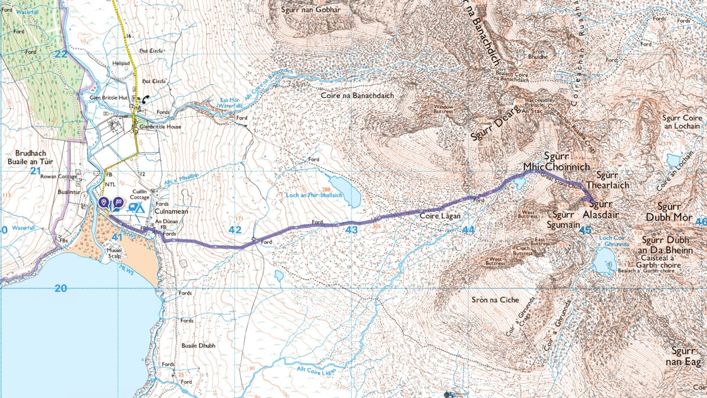
Sgurr Alasdair | Step-by-step route guide
-
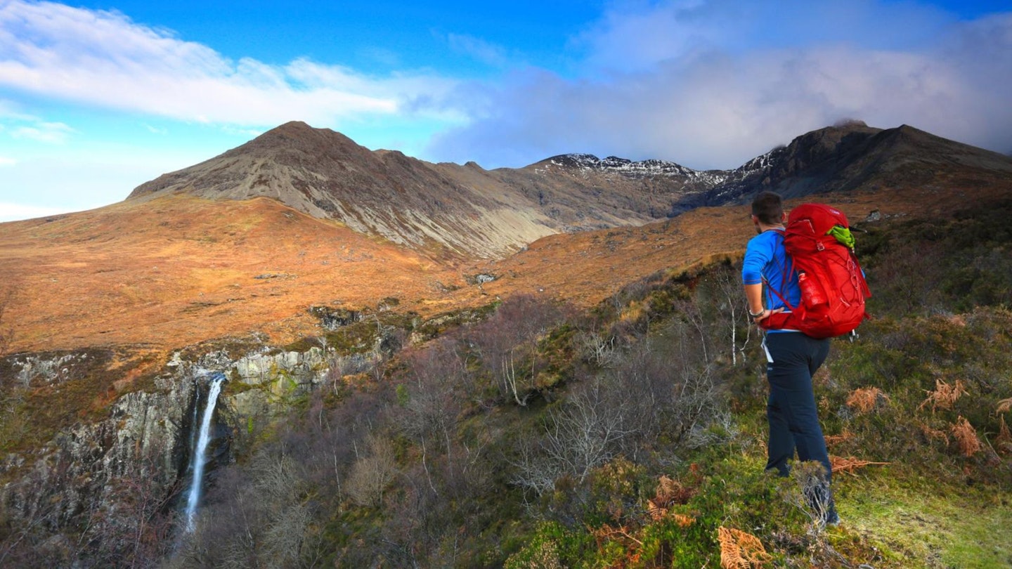
Our route starts just before the Glen Brittle Campsite, with limited parking available on the road before reaching the campsite entrance. The route follows the same route up as it does back. From parking just outside the campsite, follow the track through the site and towards the toilet block. Keep left, and exit through the wooden gate. This section is well marked with the stony footpath that’s been constructed, leading up the grassy hill.
-
As the path winds up, continue straight towards the looming mass of Sgurr Alasdair, ignoring a path branching off to the right. A small cairn will become visible. Head towards it and then beyond, scrambling up between two prominent boulders.
-
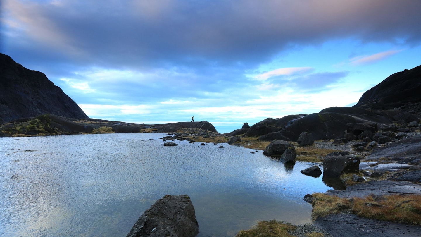
The loch will now be clearly visible, and a worn track can be distinguished going to the left-hand side, leading over rocks. The track loops around the top of the loch and aims towards the bottom of a huge scree chute, The Great Stone Chute.
-
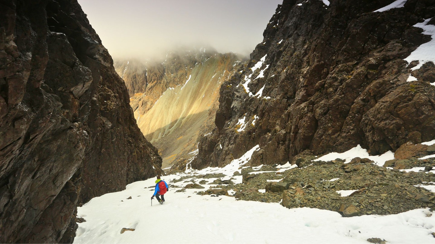
The bottom of the chute winds its way up slightly, with very loose scree making it hard going, with hands and feet needed in places to aid progression. As the ascent continues, the gully narrows between the cliffs and the rocks become larger. The top of the chute will loom into view as it reaches the steepest part. Usually, this will be distinguishable by the small bivvy spots built by fellow climbers. Be wary of stone fall if others are above you in the chute.
-
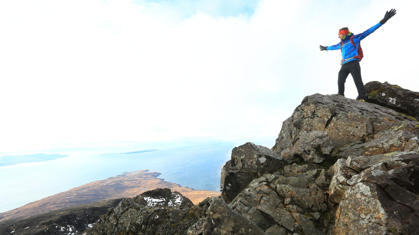
From the narrow col, the last section provides a challenging and exposed Grade 2 scramble as you ascend to the summit. The route to the top continues to the right, which is a straightforward scramble, although it is very exposed on both sides. Continue to the very narrow summit, marked by a small cairn.
-
From the summit, the views extend to the rest of Cuillin and the islands to the south-west. From here, again descend the ridge, heading slightly to the right to help with the descent. There is a small section of ledge which can also be taken, winding around the ridge to the start of the Great Stone Chute. Continue down the chute to the loch and retrace your route back to the campsite.
What walking gear do I need for this route?
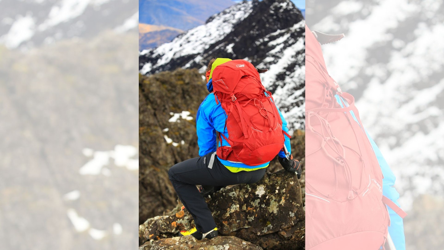
Sgurr Alasdair is a big mountain and this is a rough and rocky route, so we'd recommend investing in very good and robust kit. Walking boots are an obvious essential, as is a good hiking daypack, a reliable waterproof jacket (essential in Scotland!), an insulating layer, and a pair of quick-drying walking trousers with some packable waterproof overtrousers in your bag.
Where can I eat and drink?
The Old Inn in Carbost is around 8 miles away, www.theoldinnskye.co.uk
Where's the best place to stay?
YHA Glen Brittle is right near the start of the route and Glen Brittle campsite is one of Scotland's most spectacular sites if you're coming in the camping season. Booking.com is a great place to look for accommodation deals on Skye.
About the author
Our editor Oli Reed has done a full two-day traverse of the Cuillin Ridge (see video here) and returned to Skye a few years ago to take on this route and summit Sgurr Alasdair for the second time, as seen in the images above. He classes this as one of his best-ever days in the British mountains – and he's had quite a lot of them!