
The first time I walked over the Stiperstones I thought I’d taken a wrong turn, daydreamed down the M5 and parked up somewhere near Dartmoor.
And I assumed I was still half-asleep when road signs pointed towards an isolated hamlet called The Bog. This five-mile Shropshire ridge, part of which is a National Nature Reserve, is capped by a series of quartzite outcrops which, from a distance, look just like some of those high granite tors in the West Country.
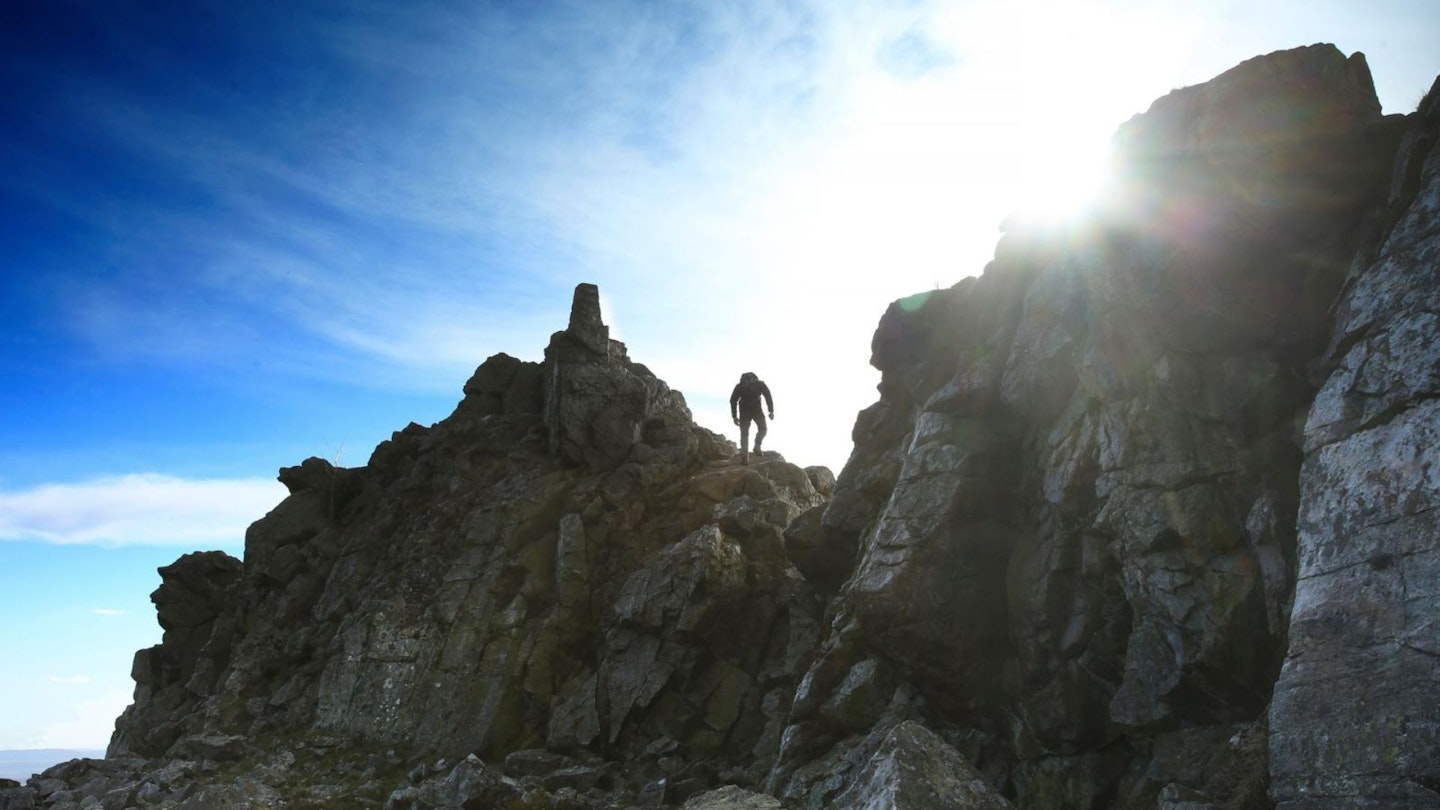
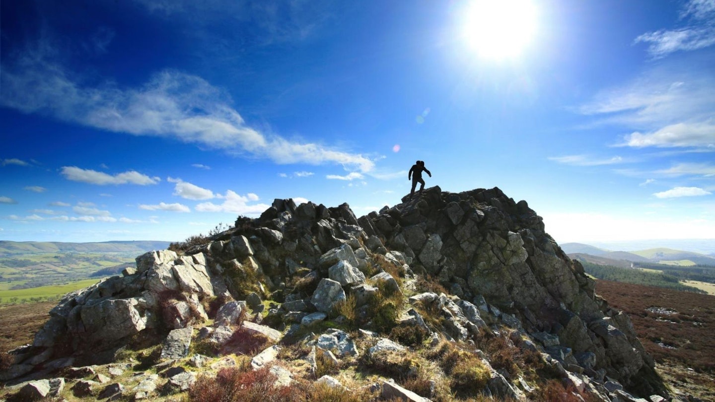
The jagged rocks offer interesting little scrambles and are a marked contrast to the flowing contours of the nearby Long Mynd.
They also provide the backdrop to a host of local legends: a ghostly Saxon warrior called Wild Edric, and the spiky crag known as the Devil’s Chair.
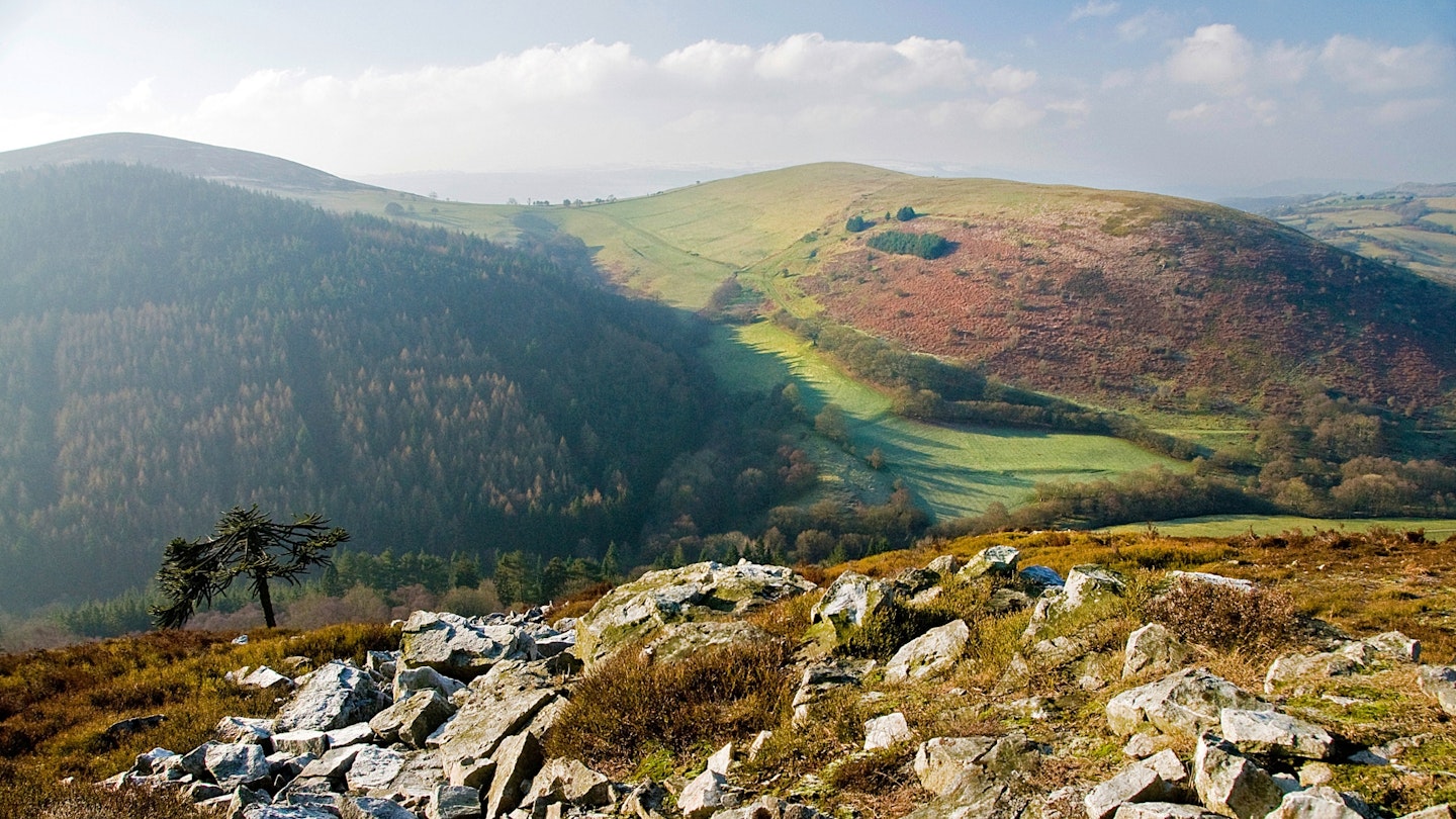
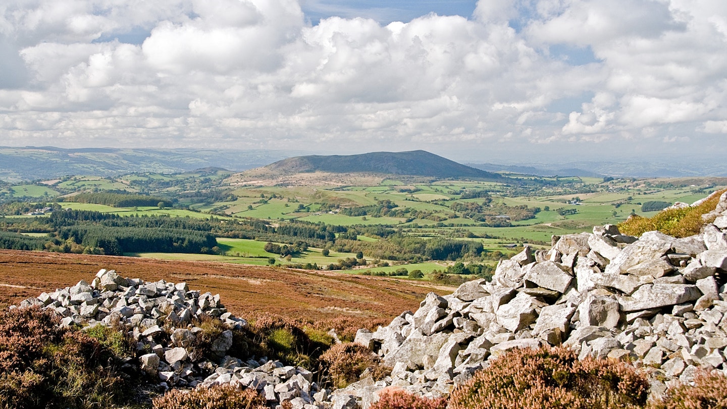
When the mist is down they say the devil is on his throne, but when the skies are clear the panoramas extend deep into Wales. Those views have got better in recent years, following a major project to remove patches of forestry, and new heather moorland now stretches south to Nipstone Rock and Black Rhadley Hill.
Deep dingles cut into the western flanks, ancient hollies cling to the windswept slopes and the scattered remains of old lead mining activity might turn you into a budding industrial archaeologist. You can find out more once you’ve returned to The Bog, where the old school is now an excellent community-run visitor centre.
How long is the Stiperstones walk?
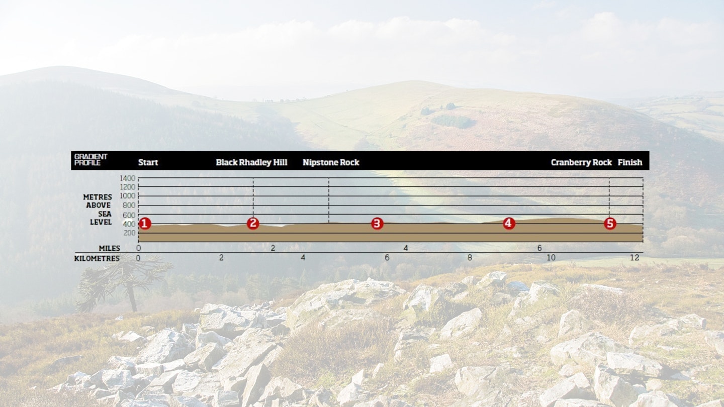
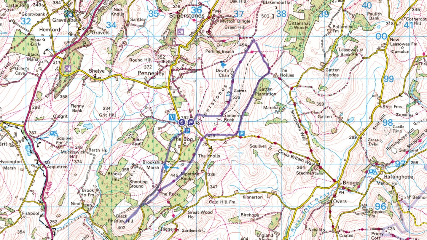
DIFFICULTY: Easy | DISTANCE: 12.2km (7.5 miles) | TIME: 5.5 hours | TOTAL ASCENT: 365m
FITNESS: No problems for anyone used to walking in hills and countryside.
TERRAIN: Rough paths; moorland; a few tracks.
NAVIGATION: The path on the ground is always obvious, but on a clear day there are very few navigational obstacles.
Where is the start of the walk?
The nearest town is Shrewsbury. Start and finish at the car park at The Bog.
What's the best map for The Stiperstones?
-
CLICK HERE to view and download our digital route guide in OS Maps
The Stiperstones walk | Step-by-step route guide
-
From the car park take the track south towards the next lane. Keep an eye out for old lead mining landmarks, including the gunpowder store, tunnels and an old incline. Cross the lane and join a track leading into a forestry plantation, with a pool on the right – this is another reminder of the lead workings. Follow the track south-south-west and, at the end of the trees, keep ahead to join a field path leading south past Rock Cottage. Carry on for another 300m to a stile leading to a narrow lane. Turn right and follow the lane for 700m until it bends left and turns downhill. Keep ahead on a track and go through a gate to climb open slopes to the top of Black Rhadley Hill.
-
Return to the gate, cross the lane and take a path into forestry. Some of the slopes ahead have been cleared of trees and there is further evidence of times past – the scree slopes below a prominent crag called The Rock are actually old mining spoil. Cross a track and head north-east over restored heather moorland to Nipstone Rock. Much of this area has been cleared under a valuable conservation programme called ‘Back to Purple’ that has seen dark conifers replaced by newly planted heather seedlings. Cross a second track and follow the path north-west along the edge of a forestry block, soon emerging into a field. Keep ahead to a small gate, cross the lane and go through another gate onto the southern slopes of the Stiperstones. Just east of here, laburnum trees can be seen growing wild in the hedgerows – it is said they were planted by lead miners who chewed the seeds as a drug!
-
Fork right and follow a bridleway leading east towards a car park. Pass through a gate at the north end of the parking area and walk north on a track-cum-bridleway with views across the broad valley of the River East Onny. Pass through another gate and continue through Gatten Plantation, where the track becomes enclosed in scrub woodland. Pass through a gate at the end of the trees and soon fork left on a track towards the crest of the ridge (signed Shropshire Way). Go through a gate onto open moorland and fork right on a track through large bilberry bushes (rich picking in July and August). Continue to meet the path on top of the broad ridge and peer down into the steep defile of Perkins Beach.
-
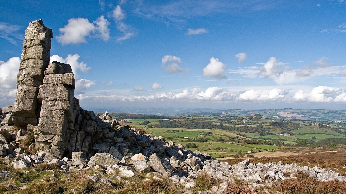
Turn south on a wide path towards the unmistakable Devil’s Chair. The path becomes surprisingly rocky as it swings to the east of the outcrops and continues south to the highest point at Manstone Rock, where scrambles up to the trig point can be made as easy or hard as you wish. The wedge-shaped hill in the west is Corndon Hill, just over the border in Wales, while the muscular slopes of the Long Mynd dominate views to the east. Continue south on the rocky path and after 400m, at the distinctive outcrop known as Cranberry Rock, turn west, downhill, across rough moorland.
-
Head for a junction of tracks where the Black Ditch, a historic feature which was possibly defensive, runs along the foot of the slopes. Fork right on a track and descend to the lane leading back to The Bog. The visitor centre has excellent displays on the history and wildlife of the area – and the cakes are good too.
What walking gear do I need for this route?
Here's a selection of the best walking gear selected by LFTO's testing team: Walking boots | Hiking daypack | Waterproof jacket | Walking trousers | Walking poles | Walking mid-layers | Base layers
Where can I eat and drink?
The best pub is The Bridges, Ratlinghope.
Where's the best place to stay?
YHA Bridges is a traditional Youth Hostel (with camping) in Ratlinghope, at the foot of the Stiperstones. You can also find good local accommodation deals in Shropshire on Booking.com
About the author

Roger Butler is one of the most experienced walking route guide writers in Britain, with a passion for climbing mountains and exploring remote Hebridean islands. His articles and photographs have featured in countless outdoor magazines over the past few decades, and he's been a long-term contributor to Trail and LFTO.
This route originally appeared in the June 2017 issue of Trail magazine. CLICK HERE to become a Trail magazine subscriber and get 50% off a whole year of digital OS Maps