Even if you’ve never heard of the Y Gribin ridge on Snowdon (not to be confused with the identically titled ridge on the Glyderau to the north), and have no idea where it is, there’s still every chance you’ve walked past it.
If you’ve ever gazed east from Snowdon’s summit on a clear day, you’ll have seen it. If you’ve ever tottered nervously across the Crib Goch arête, you’ve probably stared straight at it. And if you’ve ever walked up or down Snowdon’s Miners’ Track, you’ll have practically trod on its toes.
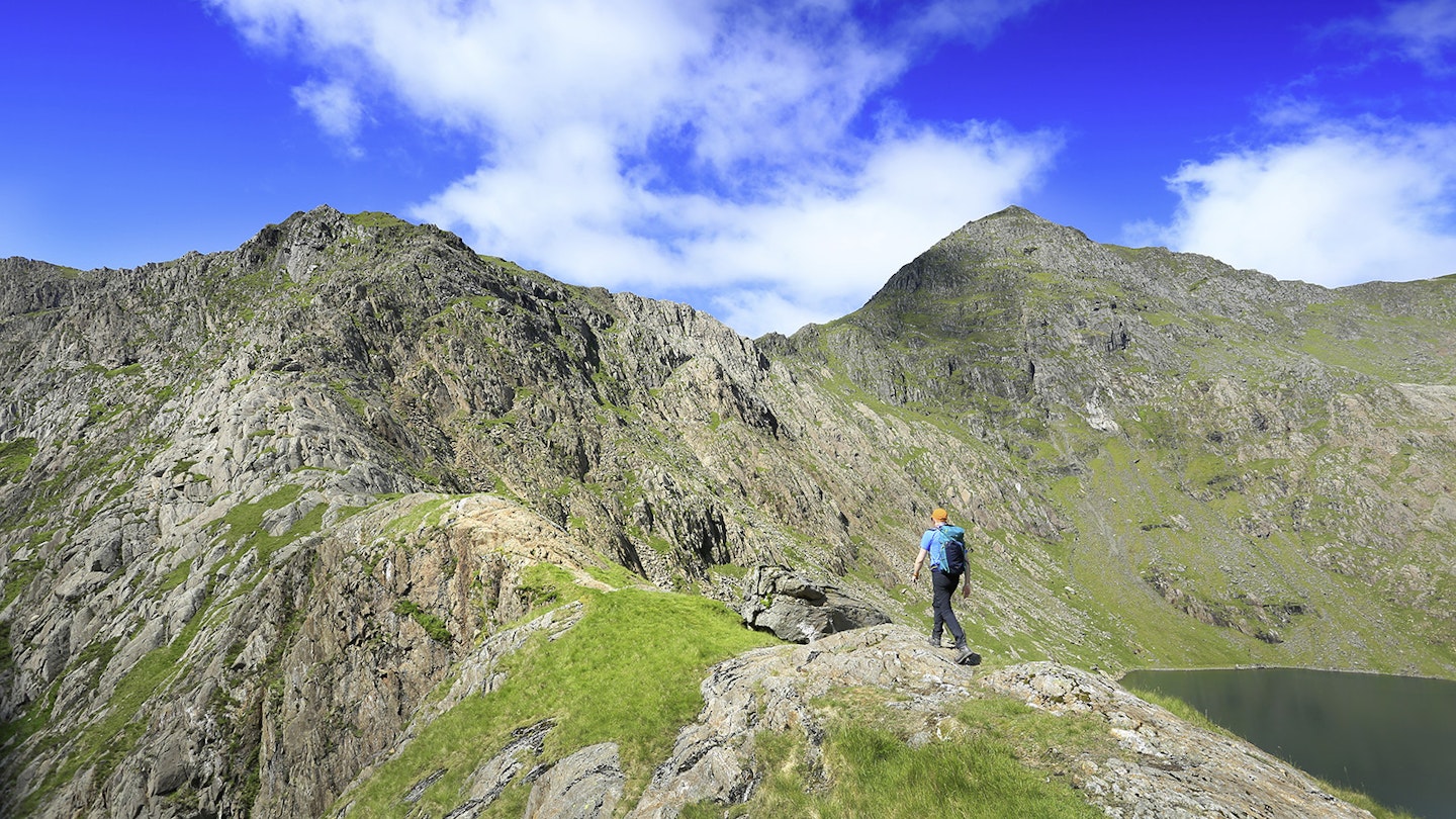
Y Gribin (named on the Ordnance Survey OL17 map simply as Cribau, which perhaps explains some of its relative obscurity) rises from the outflow of Glaslyn. From here it swerves up in a sweeping ‘S’ to split the saddles of Bwlch y Saethau and Bwlch Ciliau between Snowdon’s summit pyramid and the West Peak of Y Lliwedd. It goes at a relatively straightforward Grade 1 for its entire 180m of clambering, but still manages to dial up the excitement with some expansive exposure and an up-close-and-personal view of Snowdon’s intimidating Trinity Face.
The scenery is spectacular, the scrambling stellar and the whole experience will leave you with just one question: “Why haven’t I done this sooner?”Nestled in the middle of the Craven Fault system, Gordale Scar, a 35km geological fracture running from the borders of Cumbria into the Yorkshire Dales, can trace its history back over 300 million years. Its precise formative process isn’t certain, but it’s generally held that the gorge was formed by excessive amounts of glacial meltwater following faults (major fractures) through the rock and carving out the immense limestone canyon found here today.
Y Gribin scrambling guide
Distance 10.6km | Ascent 910m | Scramble rating Grade 1 | Go there when it’s dry. Although its position means it can remain sheltered when other scrambles are gusty, the rock is prone to becoming slippery in the wet.
1.
Pen y Pass car park (grid ref SH647556) can be full by 8am – often earlier – so it’s worth making other arrangements to get there, such as the bus from Nant Peris. From the car park, follow the Miners’ Track to Llyn Llydaw, over the causeway and up to Glaslyn.
2.
At the lake’s outflow, cross carefully over the beginnings of the Afon Glaslyn – it’s shallow but the rocks can be slippery. Ignore the track ahead over the grass slope and instead head diagonally left towards slabby rock to start the scrambling early.

3.
The rock gives way to a brief grassy break before reappearing again as a small pyramid of stone flecked with quartz. Above this you’ll find yourself on a ridge of rounded stone and grass, soon passing a large perched boulder and then meeting the ignored path as it arrives belatedly from the right.
4.
After a dome of rock and another short stretch of grass, the ridge scrambling begins proper. There are several options, and you can easily pick your own way over the grippy rock or follow the obvious signs of traffic where the ridge has been worn orange. Don’t drift too far left – the drops get big quickly.
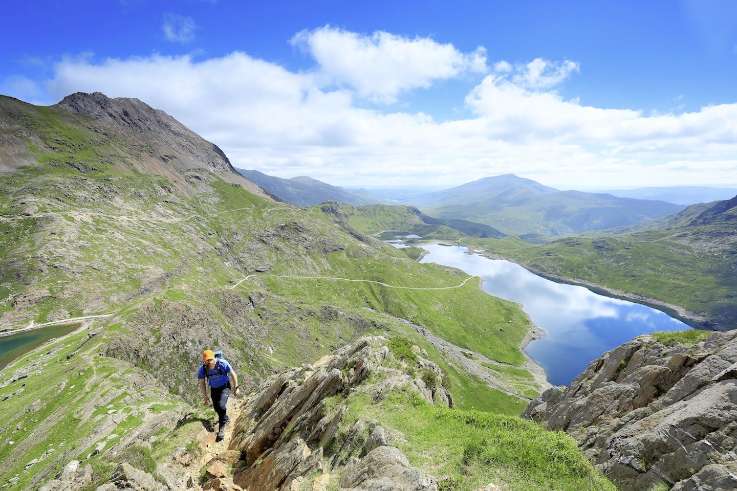
5.
When it begins to get spiky, aim to stick as close to the centre of the ridge as possible. From around the 700m contour the level of scrambling dials up a notch. Enjoy the great view of Y Lliwedd before climbing a short but steep wall on the left. The rock is polished but there are plenty of holds – just follow the obvious signs of travel.

6.
Back onto the crest, continue climbing via the crampon-scratched rock rather than the turfed gullies. At the top of this trickier section, a short loose path leads around to the left before coming up against steeper ground once more. Move back towards the centre of the ridge and enjoy the good solid rock. A small slabby patch provides the only real awkwardness, and can be easily overcome by moving to the right and then over the top of it.
7.
A few rocky metres more and the scrambling ends by a cairn on a wide grassy slope. The summit of Snowdon is off to the right, but for an even better finish to the climb with some more easy scrambling to boot, turn left and make for the summit of Y Lliwedd before descending back to Llyn Llydaw, the Miner’s Track, and the Pen y Pass car park.
Follow this route with HALF-PRICE digital Ordnance Survey Maps for the whole of Great Britain by subscribing to Trail magazine.
